
Archive
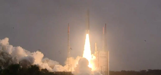
Ariane-5 Launches Four Galileo Satellites in Earth Orbit
Four new satellites of the European Galileo satellite navigation system have been successfully launched on board an Ariane 5 launcher. From mid-2018, ‘Nicole’, ‘Zofia’, ‘Alexandre’ and ‘Irina’ will allow almost
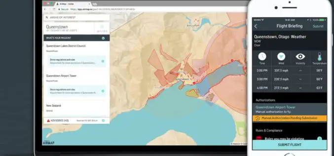
AirMap Expands to New Zealand with Airways UTM Trial
December 12th, 2017 – Big news for Kiwi drone pilots: we’ve joined forces with Airways to bring digital airspace authorization to New Zealand’s drone community. Beginning today, drone operators can use AirMap’s
Esri Technology Will Help Power the United Nations’ New Global Data Hub
Redlands, California – December 11, 2017—Esri, the global leader in spatial analytics, today announced that Esri and the United Nations Statistics Division (UNSD) are working with a number of member
SSL to Provide Access to Space for Small Satellite Constellation
SSL PODS will help enable NASA Explorers Program to study the Sun Palo Alto, Calif. – December 11, 2017 – SSL, a business unit of Maxar Technologies (formerly MacDonald, Dettwiler and Associates
Advanced Webinar: Data Analysis Tools for High Resolution Air Quality Satellite Datasets
Advanced Webinar: Data Analysis Tools for High Resolution Air Quality Satellite Datasets January 17, 2018 to Monday, January 22, 2018 High-resolution air quality data is helpful for monitoring urban air

Qatar to Develop 4D Mapping Technology to Boost Urban Planning and Other Applications
According to recent news by The Peninsula, the Center for Geographic Information Systems(CGIS) under the Ministry of Municipality and Environment is working on a cutting-edge technology to develop 4D mapping features
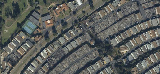
Geomni Begins Aerial Imagery Capture of California Wildfires
Flyovers began on Friday, December 8th to authorized areas, complying with FAA regulations that ensure emergency response teams can effectively combat the fires. LEHI ,UT — December 8, 2017 —

Training on Earth Observation and Geospatial Technologies for Water Resources Management in Afghanistan
Training on Earth Observation and Geospatial Technologies for Water Resources Management in Afghanistan 17 Dec 2017 to 27 Dec 2017, Kabul University As part of its series of capacity building initiatives
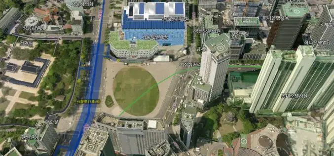
Seoul to Get New 3D Map
According to recent news by The Korea Times, the Seoul Metropolitan Government will launch a 3D mapping project for 11 of the city’s hotspots, including City Hall, Lotte World Mall and

Pix4D is Expanding Globally
Capturing a billion dollar market with advanced computer vision, machine learning, and photogrammetry December 07, 2017 – Pix4D is adding two senior executives to our leadership team to strengthen our global
