
Posts From GIS Resources
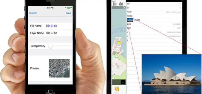
iOS Mapping Solution, SuperSurv, Enhances Raster Data Support
Supergeo releases the latest update of SuperSurv 3.2 (iOS) to enhance the functionality and efficiency for mobile GIS surveyors. Having stronger compatibility with raster dataset and convenient tools for data
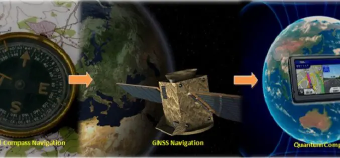
Will Quantum Compass Replace Global Navigation Satellite System (GNSS)?
Submitted by: Understanding the location on the planet Earth is always been important for human beings. In ancient time humans were using celestial objects or astronomical observations to determine their

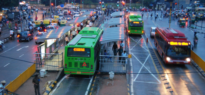
Pakistan to Introduce Smart Phones for Digital Mapping of Dengue
According to recent news, Dengue Prevention and Control Programme (DPCP) Sindh (Pakistan) to introduce smart phones for digital mapping of high-risk areas of dengue larva breeding points, patients and
Central Silk Board Using GIS for Potential Areas for Sericulture Expansion
India- the Central Silk Board under the Ministry of Textile has taken up a project to identify potential areas for sericulture expansion using GIS and remote sensing technology. The project
Regional Seminar on Geospatial Technology in Natural Resource Management at PRSC
Regional Seminar on Geospatial Technology in Natural Resource Management 17-18 March, 2015, Punjab Remote Sensing Centre, Punjab, India The maiden attempt of India in reaching Mars has ranked our nation in
Government Sanctions Rs. 10 Crore for Mapping Accident Maps
The Union Minister for Road Transport and Highways Nitin Gadkari has said the government has sanctioned Rs 10 crore to Central Road Research Institute (CRRI) for locating regular accident prone

CIDCO to Sign MoU to Construct Palghar’s infrastructure
Thane, Mumbai: City and Industrial Development Corporation (CIDCO) Vice Chairman and Managing Director Sanjay Bhatia said here today that the state-owned corporation plans to sign an MoU to construct infrastructure
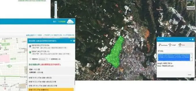
Brain of Smart City: A GIS Platform for Sharing 2D and 3D Maps
Smart City, defined as utilizing digital technologies to trim costs and resource consumption to engage its citizens more effectively in various domains like transport, health care, energy, water, and so
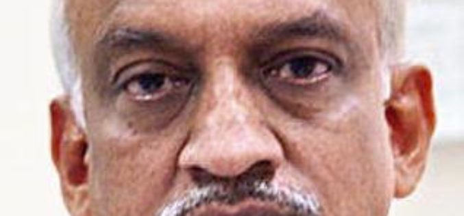
Alur Seelin Kiran Kumar Takes Over as Space Secretary
Distinguished space scientist Alur Seelin Kiran Kumar took over as secretary of the department of space and chairman of the Space Commission and the state-run ISRO here. Prior to his appointment to
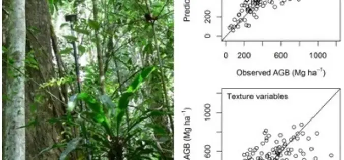
Modeling Aboveground Biomass in Dense Tropical Submontane Rainforest Using Airborne Laser Scanner Data
Modeling Aboveground Biomass in Dense Tropical Submontane Rainforest Using Airborne Laser Scanner Data – Endre Hofstad Hansen, Terje Gobakken, Ole Martin Bollandsås, Eliakimu Zahabu and Erik Næsset Abstract: Successful implementation of projects
