
Featured Article

LiDAR Technology Uncovers Hidden Silk Road Cities in Uzbekistan
Recent advancements in LiDAR (Light Detection and Ranging) technology have revealed hidden remnants of Silk Road cities in Uzbekistan, uncovering archaeological treasures that had remained buried for centuries. The discovery

Taiwan Uses Satellites for Banana Disease Detection
The Taiwan Space Agency (TASA) is utilizing advanced satellite-based banana disease detection to address a critical issue in agriculture—detecting and managing the devastating Fusarium Tropical Race 4 (TR4) disease in
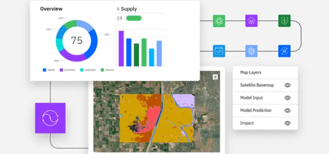
Exploring the Power of IBM Environmental Intelligence APIs for Geospatial Insights
The IBM Environmental Intelligence APIs are designed to equip data scientists and developers with high-quality environmental data sets. These APIs offer a comprehensive set of geospatial, climate, and weather data,
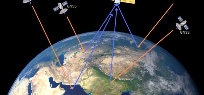
Ginan an Open-Source Real-Time Positioning Correction Service
As the demand for highly accurate positioning systems grows, Geoscience Australia has launched Ginan, an open-source real-time positioning correction service. Developed as part of the Positioning Australia program, Ginan offers
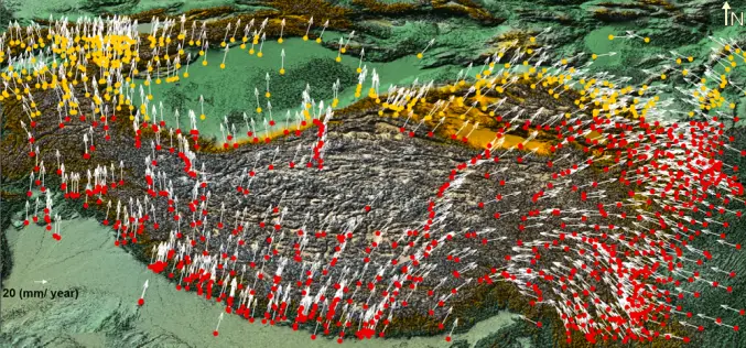
Enhancing Tectonic Studies with Machine Learning For Crustal Velocity Prediction
Crustal deformation is a critical area of study, especially in tectonically active regions like the Tibetan Plateau. In their research, Bappa Mukherjee, et. al. present a novel approach using machine
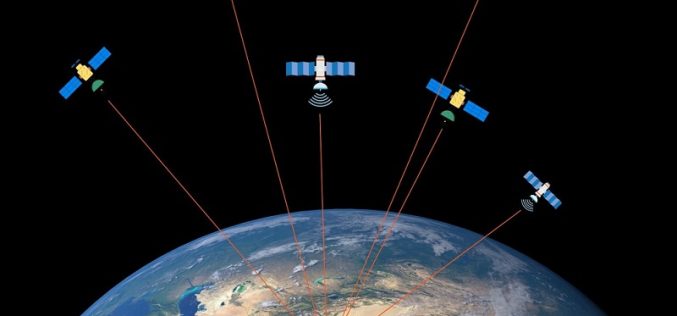
What is GNSS Reflectometry? How Does GNSS Reflectometry Work? Understanding Its Principles and Applications
GNSS Reflectometry (GNSS-R) is an innovative remote sensing technique that leverages signals from Global Navigation Satellite Systems (GNSS) reflected off the Earth’s surface. Originally designed for navigation and geodetic applications,

How Spatial-Temporal Data Revealed Hepatitis B Patterns in China
Hepatitis B virus (HBV) infection remains a significant public health concern in China, a country with one of the highest burdens of this disease worldwide. Despite ongoing efforts to control

What is Digital Twin and How Does It Work?
In today’s rapidly evolving technological landscape, Digital Twin technology has emerged as a groundbreaking innovation, especially in the geospatial sector. Digital twins are virtual replicas of physical entities that mirror

Harnessing Geospatial Technologies for Wildlife Conservation
Geospatial Technologies for Wildlife Conservation underscores the urgency of wildlife conservation, which has never been more pressing. With rapid habitat loss, climate change, and increased poaching, numerous species face the

Understanding the Importance of L5 Frequency in GNSS
The Global Navigation Satellite System (GNSS) has revolutionized the way we navigate and position ourselves in the world. With continuous advancements, one of the most significant developments in recent years
