
Featured Article

GeoSynth: AI To Create Satellite Images From Text Prompts
Imagine a world where you can conjure detailed satellite images merely through verbal descriptions. This is the groundbreaking capability of GeoSynth, a generative AI-driven system transforming satellite imagery. GeoSynth’s prowess

How Remote Sensing Helps to Curb Illegal Mining
Illegal mining is a pervasive global issue that poses severe environmental, economic, and social threats. It involves the unregulated extraction of valuable minerals and metals, leading to deforestation, water pollution,
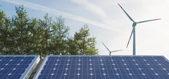
Geospatial Technology Applications in the Renewable Energy Sector
Energy is always in demand both for household and industrial use, and the Earth’s population has to manage energy source depletion before running short. Renewable energy sources are a great
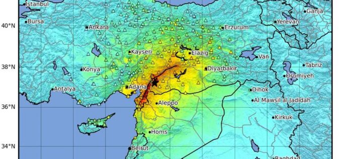
Towards Earthquake Early Warning Systems: Insights from Satellite Data on the 2023 Türkiye Earthquake
Recent studies have revealed that satellite data detected anomalies in the ionosphere up to 19 days before the devastating earthquake in Turkey on February 6, 2023, highlighting the potential for

Call for Proposals for Geospatial Technology and Solutions: Impact and Importance for India’s Future
The National Geospatial Programme (NGP) division, formerly NRDMS, calls for proposals in Geospatial Technology and Solutions that have the potential to impact various sectors in India significantly. The National Geospatial

Understanding China’s BeiDou-Only Mandate: Strategic and Global Implications
According to recent news by MSN, China is launching a new campaign to crack down on the theft of sensitive geographical data by foreign powers with its BeiDou-only mandate, the
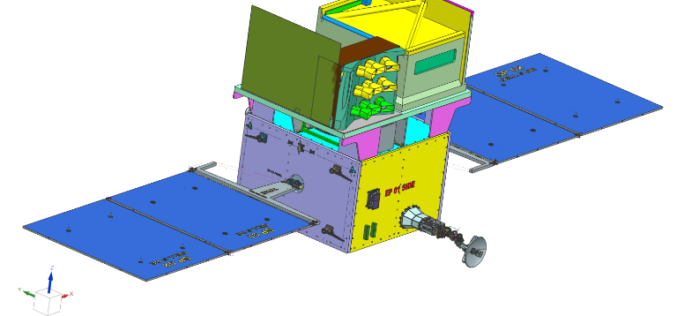
TRISHNA Mission Set to Revolutionize High-Resolution Thermal Imaging
The TRISHNA Mission, a collaborative endeavour between the Indian Space Research Organisation (ISRO) and the French space agency CNES, is set to revolutionize the monitoring of Earth’s surface temperature. TRISHNA
Ordnance Survey Expands as a Distributor of Third-party Government Data
Ordnance Survey (OS), Great Britain’s leading geospatial data provider, and BGS, the UK’s leading scientific earth data provider, both Geo6 members, are driving an exciting new development. It is the

Efficiency, Safety, and Sustainability through Innovative Technology
STRABAG leverages innovative technology to make work more efficient, improve worker safety and drive sustainability in urban areas. Geospatial technologies and surveyors play a crucial role in developing infrastructure and

Benefits of Geospatial Data in Driving Analytics
Geospatial data has become an indispensable asset in today’s increasingly data-centric era, providing businesses, governments, and researchers alike with invaluable resources for making strategic decisions and driving transformation across multiple
