
GIS
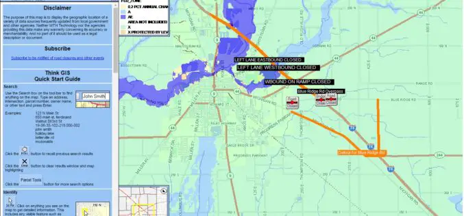
Shelby County, Indiana to Get New Mapping System
According to recent news reported by The Shelbyville News, Shelby County’s GIS board of directors has given up a positive node to the purchase of the new LIDAR mapping database. All

Hyderabad Metropolitan Development Authority Plan to Integrate Previous Five Master plans
Hyderabad, India – According to recent news reported by The Hindu, Hyderabad Metropolitan Development Authority (HMDA) is planning to integrate previous five master plans into a single Metropolitan Development Plan (MDP)

Digitalization Should Be Used To Connect Separate Products and Systems: Hitachi
Mumbai, India, IANS – The key challenge in today’s context is to use digitalization to link system deliverables to provide integrated solutions to issues of rapid urbanization, sustainable transportation, water
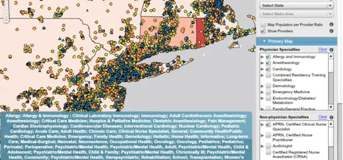
AMA Unveils Enhanced Interactive Mapping Tool Aimed at Helping Health Care Providers
Recently the American Medical Association (AMA) has launched an interactive mapping tool (Health Workforce) to further help physicians and other healthcare providers improve patient access to care. In addition to
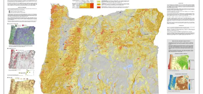
Oregon Landslide Mapping Methods Defined in New Paper
PORTLAND, Ore. – A new paper shows how Oregon geologists map the state’s susceptibility to deep landslides. The paper, published today by the Oregon Department of Geology and Mineral Industries

South Korea and Tunisia Sign MoC in the Field of Geospatial Data
As recently reported by ZAWYA (Thomson Reuters), South Korea and Tunisia has inked a memorandum of technical co-operation in the fields of geospatial data and land management in the event

ASTEC Launches Space-based Program for Empowering Panchayati Raj Institutions
Guwahati, India -According to recent news reported by The Assam Tribune, the Assam Science Technology and Environment Council (ASTEC) has launched outreach activities for space-based projects Empowering Panchayati Raj Institutions

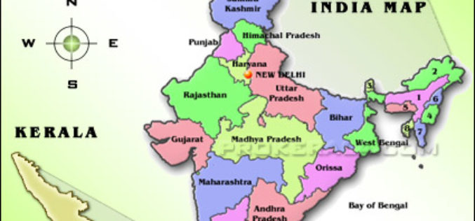
NESAC Technology to Monitor Progress of 700 NEC Projects: India
Umiam (Meghalaya), Sep 5 (PTI) – Around 700 government projects funded by the North Eastern Council, which are facing delay and cost over-run in eight states of the north east
Fiji to Adopt GIS for Early Detection of Vector Borne Diseases
According to recent news published by the Fiji Sun Online, Fiji Centre for Communicable Diseases Control has conducted a two-week training programme on early detection of vector-borne diseases. Training was conducted by
Sustainable Land Utilization Modeling Using GIS and Remote Sensing
According to recent news published by The Hindu, The Kerala State Land Use Board (KSLUB) is gearing up to prepare a comprehensive data bank of resources coming under the Thiruvananthapuram
