
GIS

India to Ink Agreements With US on Sharing Geospatial Information and Data
According to recent news published by The Indian Express, following the inking of an important logistical pact (LEMOA) with the US, Defence Minister Manohar Parrikar has indicated that India is

Get Ready for the New Small Drone Rule!
A new world of opportunities for drone operators opens next week on August 29 when the new small drone rule for non-hobbyists becomes effective. The Federal Aviation Administration (FAA) wants
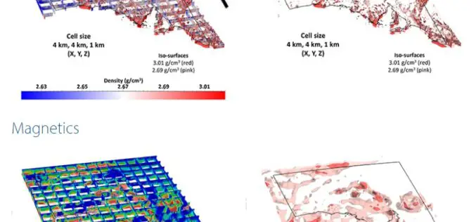
3D Geophysical Exploration Model Covers All South Australia
Integrating 3D geophysical data to a depth of 100 km The South Australian Geophysical Reference Model allows users to bring to life the state’s vast resource data sets of geological
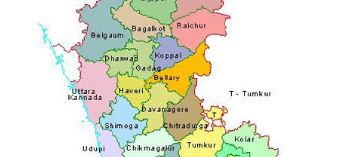
Karnataka to Identify Flood-prone Areas With New Maps and Geo-apps
Karnataka, India – According to recent news by the ET Tech, the Karnataka State Natural Disaster Monitoring Centre (KSNDMC) has initiated an exercise to develop high-resolution contour maps for Bengaluru
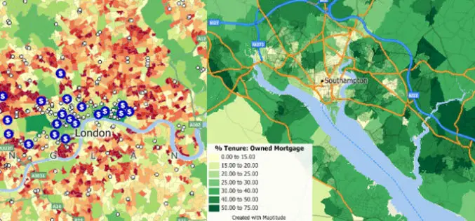
Use of GIS in Banking
Contributed By – Site Selection for New and Relocated Branches It’s not difficult to comprehend the basic idea of depicting market statistics on maps in an effort to evaluate locations. But
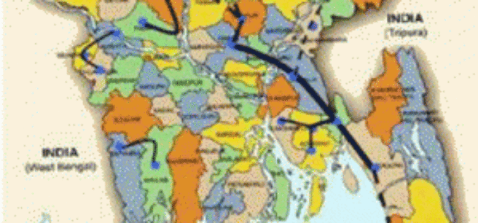
Bangladesh Telecommunication Regulatory Commission Unveils GIS Map of Nationwide Optical Fiber
According to recent news by the Prothom Alo, the Bangladesh Telecommunication Regulatory Commission (BTRC) has unveiled a web-based interactive GIS map of optical fiber laid across the country, which shows

NDMA Holds Meeting on Landslide Risk Management Strategy
ANI – The National Disaster Management Authority (NDMA) today called on a meeting to discuss the formulation of a National Landslide Risk Management Strategy. This was the first meeting of
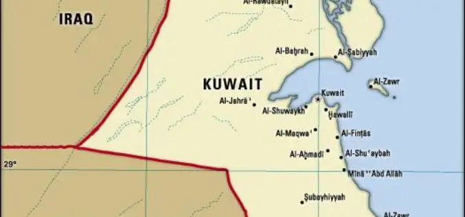
Kuwait to Use GIS for Monitoring Violations by Factories
According to recent news reported by Kuwait News Agency (KUNA) – The Public Authority for Industry (PAI) stressed the importance of the satellite-connected Geographic Information System (GIS) which aims at securing

Open Geospatial Consortium Requests Participation in its Marine DWG
The Open Geospatial Consortium (OGC®) is calling for public participation in its newly-established Marine Domain Working Group (Marine DWG). The Marine DWG was established to address applicability of the OGC
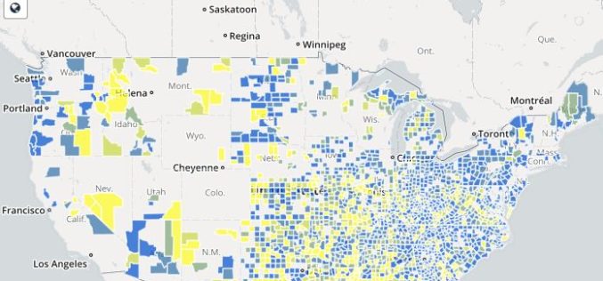
Mapping Broadband Health in America
The Connect2Health Task Force’s Mapping Broadband Health in America tool allows users to visualize, overlay and analyze broadband and health data at the national, state and county levels – informing policy
