
GIS

Google Free Mapping Service Adds Local Guides
San Francisco: An update to Google`s free online mapping service on Friday let users become local guides who post reviews of businesses and venues in a challenge to

Utilities and Customers Benefit from Intergraph Outage Notifications
Solution generates automated notifications improving customer outage experience HUNTSVILLE, Ala., Feb. 4, 2015 – Intergraph® will help utilities improve customer service during electricity outages with the release of Intergraph Outage

Esri’s Data Appliance for ArcGIS Now on GSA Schedule
Agencies Can Gain Secure Access to Terabytes of Valuable Data behind Their Firewall Redlands, California—Esri today announced that Data Appliance for ArcGIS is available on the General Services Administration (GSA)

President’s 2016 Budget Proposes $1.2 Billion for the USGS
Reflects robust Administration support for science-based decision-making in managing natural resources The President’s fiscal year 2016 budget request for the U.S. Geological Survey is $1.2 billion, an increase of nearly
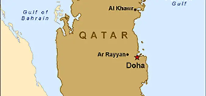
Qatar is Using GIS to Map and Analyse Fishing Reserves
In recent news, Qatar is developing a geographical information system (GIS) to map and analyse its marine resources, mainly fishing reserves. The fisheries department is busy assessing the country’s fish reserves
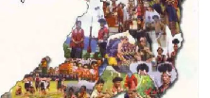
Nagaland Doing Mapping on Ground Water Prospects
Nagaland Science and Technology Council (NASTEC) has prepared a map on ‘Ground water prospects of Nagaland’. NASTEC prepared the Hydro Geo-Morphological (HGM) Map under Rajiv Gandhi National Drinking Water Mission
Geospatial Innovation in Spotlight at Esri Conference in DC
NGA Director Robert Cardillo and Former Maryland Governor Martin O’Malley to Keynote Redlands, California—Technology and government leaders will gather for the Esri Federal GIS Conference in Washington, DC, February 9–10,
ArcGIS 10.3 and ArcGIS Pro Modernize GIS for Organizations and Enterprises
New Release Enables Users to Create, Share, and Explore Maps on Any Device Esri has announced (Jan 27, 2015) that ArcGIS 10.3 is now available with the release of ArcGIS Pro.
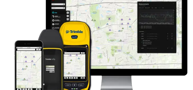
Trimble Unity — Next Generation Suite of Software Applications for Water, Wastewater and Stormwater Utilities
Trimble Unity Replaces Trimble Connect for Water and Offers Unified Cloud-based and Mobile Collaboration Platform for Smart Water Mapping and Work Management Trimble has introduced its next generation suite of software applications

Polytechnic University of Marche, Italy, Select SuperGIS for Geospatial Applications
The Polytechnic University of Marche, Italy (aka, UNIVPM) selects SuperGIS Desktop to build a professional teaching laboratory of engineering, environment observation and agriculture, to train outstanding geographic information personnel. Ranking
