Free SuperGIS Webinar – Optimizing the Use of Data with SuperGIS Desktop in A Cost-effective Way

Optimizing the Use of Data with SuperGIS Desktop in A Cost-effective Way
Wednesday, 2nd April 4:00 PM – 5:00 PM (GMT+8)
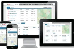
Worldwide users are looking for powerful GIS technologies to facilitate complex GIS tasks and support better decisions. The webinar will show you how to utilize newly-launched  SuperGIS Desktop 3.2 to optimize GIS data creation, integration and utilization, to fulfill a variety of solutions with the least costs. Don’t miss it!
In this Webinar You Will Learn How to:
- Conduct complex GIS data manipulation and geoprocessing
- Simplify GIS data generation by SuperGIS Cache Generator and Geospatial PDF
- Effectively interact and manage large data from Geodatabases
- Create your own map atlas by Feature Guided Pages
- Build up precise mapping information for surveying using COGO and Advanced Editor
Who Should Attend?
GIS professionals, Analysts, Managers, Urban planners, Surveyors, and anyone who are interested in advanced and cost-effective GIS technologies.
Speaker
Ava Lai
Senior International Support Engineer of GIS Training & Support Center, Supergeo Technologies Inc.
Ava has a master degree in Oceanography from National Taiwan University. With the strong passion for geospatial technologies, she has excellent product and project expertise to support global GIS users. Ava joined Supergeo in 2012, providing professional technical support and training for Supergeo users.
How to Register
Click here to Register Now
Source: SuperGeo; epaper@gisforum.com.tw