
Tag "Elevation data"
UP42 Partners with Intermap to Bring High-Resolution Elevation Data to UP42’s Geospatial Marketplace
UP42 is pleased to announce that the NEXTMap Elevation Data Suite from Intermap Technologies is now offered on the UP42 developer platform for Earth observation data and analytics. The NEXTMap

Global Mapper Adds Online Access to NEXTMap One™ Elevation Data from Intermap
Hallowell, Maine – October 11, 2018 – Blue Marble Geographics (bluemarblegeo.com) is pleased to announce the immediate availability of NEXTMap® worldwide elevation data, including Intermap’s newest generation NEXTMap One, as
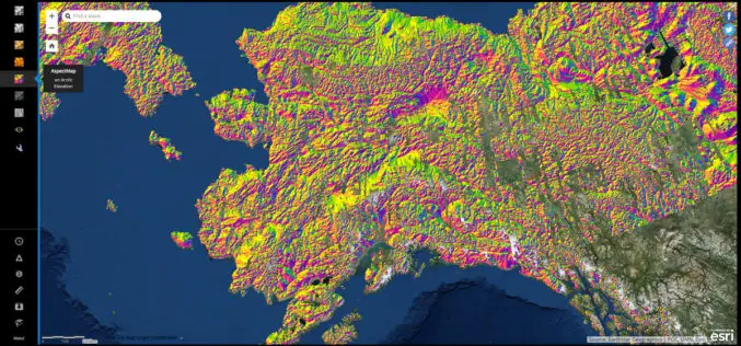
NGA Releases Biggest Collection of Arctic Elevation Data Yet at Esri FedGIS Conference
ArcticDEM Provides High-Quality Elevation Data and Enables Communities to Take Action Redlands, California—Esri, the global leader in spatial analytics, together with the ArcticDEM project—a public-private initiative to produce high-resolution, high-quality
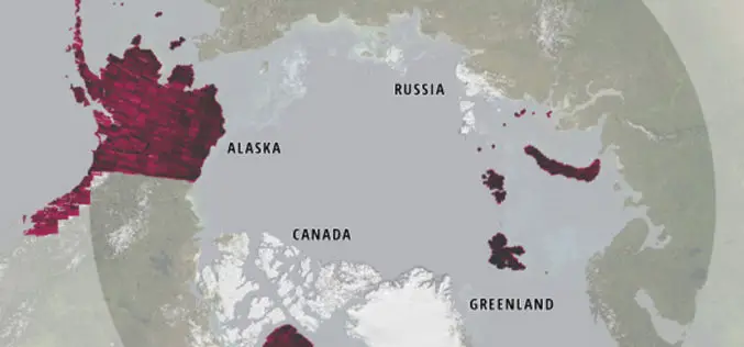
Esri Releases New Arctic Elevation Data
ArcticDEM Provides New Insight into Effects of Climate Change and Enables Communities to Take Early Action Redlands, California—Global smart-mapping leader Esri and the ArcticDEM project, a public-private initiative to produce
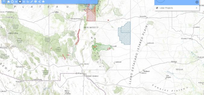
New Mexico Lidar Data Status Map
Increasingly, New Mexico’s key geospatial data needs must be met with high-quality, high-resolution, and current elevation data. Enhanced elevation data are essential to a broad and cross-cutting range of applications,

Make Better Geospatial Decisions with Accurate Elevation Data
ENVI Webinar: Make Better Geospatial Decisions with Accurate Elevation Data November 5, 2015; 3:30 PM Berlin (GMT +2); 1PM New York (GMT -4) Precise elevation data is the initial foundation of any accurate geospatial

Webcasts: Creating Digital Terrain Models with ImageStation DTM for GeoMedia
Creating Digital Terrain Models with ImageStation DTM for GeoMedia Accurate and up-to-date elevation data layers provide the foundation for a wide variety of applications, from urban change detection to transportation

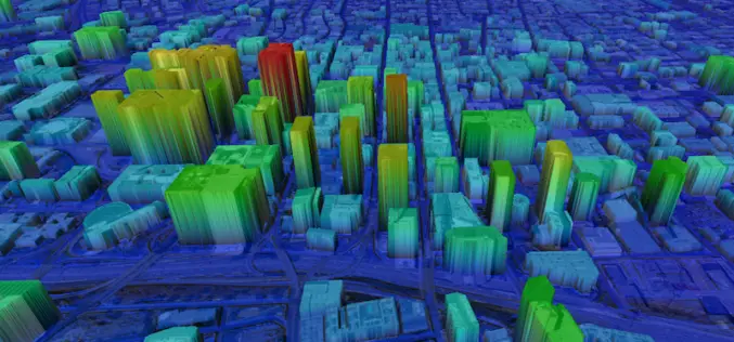
Who Else Want to See World in 3D
Vricon, developed as a joint venture of Saab and DigitalGlobe, Inc., is to produce data rich 3D model of world. DigitalGlobe and Saab will combine their strengths to both support and own Vricon. Saab will
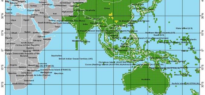
More Global Topographic Data to Aid Climate Change Research
Enhanced elevation data for most of Asia and Oceania; third of four releases Improved global topographic (elevation) data are now publicly available for most of Asia (India, China, southern Siberia,

Enhanced Elevation Data for North and South America, Pacific Islands, Northern Europe
New Heights of Global Topographic Data Will Aid Climate Change Research The U.S. Geological Survey announced today that improved global topographic (elevation) data are now publicly available for North and
