
Tag "Geographical Information System"

Reliance Energy Launches App for Complaints on Defective Street Lights
September 28, 2017, Mumbai – (IANS) – In an effort to make Mumbai streets safer after dark, Reliance Energy has launched a new app-based service for lodging complaints on defective street lights,

ISRO Successfully Launches Cartosat-2 Series Satellite Along with 30 Co-passenger Satellites
Jun 23, 2017 – ISRO’s Polar Satellite Launch Vehicle PSLV-C38 successfully launched the 712 kg Cartosat-2 Series Satellite along with 30 co-passenger satellites today (June 23, 2017) from Satish Dhawan Space

Uttar Pradesh: New Government Schools Only After GIS Mapping
Uttar Pradesh, India – According to recent news by The Hindustan Times, Uttar Pradesh will now get new government-run primary and upper primary schools only after completion of Geographic Information System

Cyient Collaborates with Amdocs to Implement Geographical Information System as Part of Netlink Trust’s Next-Generation B/OSS Project
Joint solution will accelerate fiber connectivity rollout, reduce fault repair and outage time, and improve service quality Singapore, April 04, 2017 – Cyient, a global leader in communications engineering and
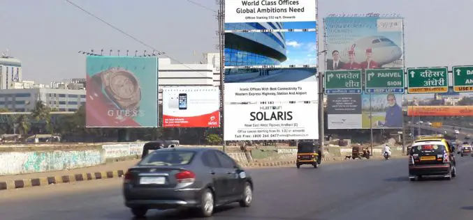
Bruhat Bengaluru Mahanagara Palike to Use GIS for Hoarding Management
Bengaluru – According to recent news by The New Indian Express, the Bruhat Bengaluru Mahanagara Palike (BBMP) is planning to take help of the Geographic Information System (GIS) in order

Course on GIS Analysis with QGIS
GIS Analysis with QGIS 6-10 February 2017 QGIS is the most popular and reliable Open Source GIS in the world. QGIS is currently used in Universities, Public Facilities and private
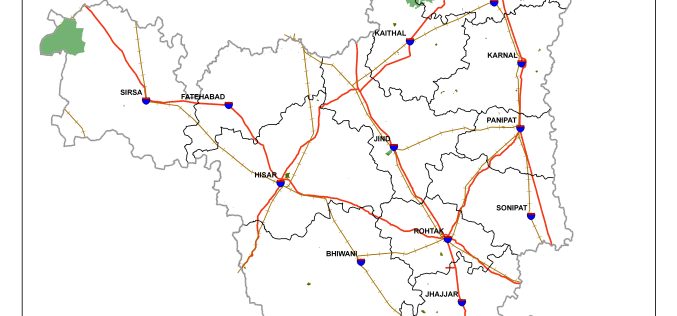
Haryana is Developing GIS-based Digital Map of Forest Areas in the State
According to the recent news, Haryana forest department is using geographic information system (GIS)-based digital mapping of forest areas in the state, this will add better monitoring and conservation of

Tanzanian City Deploys GIS to Raise Revenue Collection
According to recent news by the All Africa, Dar es Salaam Municipal Council, Tanzania is expecting to collect 60bn/- per year up from 6.0bn/- after improvement on the geographic information system (GIS). The

Digitalization Should Be Used To Connect Separate Products and Systems: Hitachi
Mumbai, India, IANS – The key challenge in today’s context is to use digitalization to link system deliverables to provide integrated solutions to issues of rapid urbanization, sustainable transportation, water
Fiji to Adopt GIS for Early Detection of Vector Borne Diseases
According to recent news published by the Fiji Sun Online, Fiji Centre for Communicable Diseases Control has conducted a two-week training programme on early detection of vector-borne diseases. Training was conducted by
