
Tag "geospatial data"
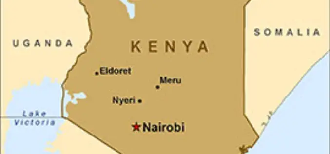
Kenya to Have its First Geospatial Data Centre
According to recent news by IT Web Africa, Kenya could have its its first geospatial data centre by June next year, proposes to cost of Kshs 800 million (US$8m), to
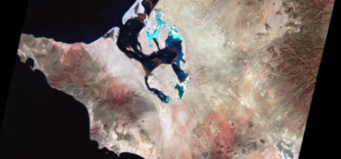
Earth on AWS: Large Geospatial Datasets Available on the Amazon Web Services
Amazon Web Services (AWS) had launched the Landsat on AWS in the year of 2015, a Public Dataset made up of imagery from the Landsat 8 satellite. On September 16, 2016 (AWS Blog),

South Korea and Tunisia Sign MoC in the Field of Geospatial Data
As recently reported by ZAWYA (Thomson Reuters), South Korea and Tunisia has inked a memorandum of technical co-operation in the fields of geospatial data and land management in the event

East View Geospatial Introduces New Image Analysis Services
Minneapolis, Minn. – August 25, 2016 – East View Geospatial is pleased to announce the launch of new image analysis services designed to complement the company’s ever-expanding sources of satellite data

Location Powers Workshop to Advance Geospatial applications of Big Data
The Open Geospatial Consortium (OGC®) has announced its Location Powers: Big Data workshop, occurring on Tuesday 20th September in Orlando, Florida. The Location Powers: Big Data workshop will bring together
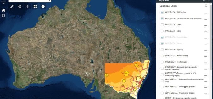
New South Wales Government Launches Renewable Energy Resources Map
In a recent news release by the New South Wales Government, in a state first, NSW will have a renewal energy map to help drive investment in new renewable projects across
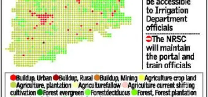
Telangana Goes for Geo-tagging With the Help of NRSC and ICRISAT
According to recent news by The Hindu, soon the citizens, farmers, administrators and policy makers can gain access to information about water availability and cropping pattern in all irrigation systems

Create, Share Geotagged, Media-rich Field Reports With New NGA Mobile App
The National Geospatial-Intelligence Agency’s latest publicly available mobile app is now available on iTunes and Google Play. The Mobile Awareness GEOINT Environment, MAGE, was developed to support first responders deploying

Airbus Defense and Space Partners with AMREL for Easy Access to Geospatial Data for GEOINT Operations
Airbus Defense and Space and American Reliance, Inc. (AMREL) have partnered to integrate GATOR (Geospatial Appliance Targeted for Operational Response) into a rugged one-box laptop solution called the GATOR Rugged
‘Geospatial Bill’ Step in Right Direction, But Needs Revamping: FICCI
FICCI said that govt should reconsider some aspects regarding mechanism for acquisition, storage, dissemination and distribution of data The Federation of Indian Chambers of Commerce and Industry (FICCI) appreciated the
