
Tag "GIS data"
Esri Updated Standard Global Demographic Data for 45 Countries
Esri has updated the Standard Global Demographic data for the 45 countries and is now available on the ArcGIS platform. The data is sourced from Michael Bauer Research, is available across the ArcGIS

Blue Marble Geographics Announces its 2015 6th Annual User Conference in Arlington, Virginia
Blue Marble Geographics (bluemarblegeo.com) is pleased to announce that the 2015 Blue Marble User Conference (BMUC) will take place in Arlington, VA on Tuesday October 6. This annual event provides

New Leica Zeno 20 redefines GIS data collection
Leica Geosystems has unveiled its new GIS data collection solution, the Leica Zeno 20 – an extremely accurate and intuitive solution. The Leica Zeno 20 is the first high accuracy

Wow ! Google Earth Pro Is Now Free
Recently Google has announced that Google Earth Pro is now available for free. Google Earth Pro is geospatial software that has all the easy-to-use features and detailed imagery of Google Earth, along with

Esri Training Seminar: Streamline GIS Workflows with ArcGIS Pro
Streamline GIS Workflows with ArcGIS Pro Thursday, January 29, 2015 Seminar Overview: ArcGIS Pro is a new desktop application included with ArcGIS 10.3 that is designed to help GIS professionals

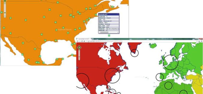
SuperGeo Webinar: Top 10 Features SuperGIS Desktop
SuperGeo Webinar: 10 Most Useful Features of SuperGIS Desktop 5th February, 11:00 AM – 11:30 AM (India Standard Time) Are you looking for powerful and comprehensive GIS solutions? Something that may

W3C and OGC to Collaborate to Integrate Spatial Data on the Web
6 January 2015 — The W3C and the Open Geospatial Consortium (OGC) announced today a new collaboration to improve interoperability and integration of spatial data on the Web. Spatial data

SuperGIS Webinar: Monitor Environment Changes with 3D GIS Tech
Supergeo is going to hold a webinar to show how 3D GIS can be applied to rapid changes of natural and urban environments with SuperGIS 3D Earth Server 3.2, the
Various APIs in SuperGIS Server 3.2 Improve Customization Flexibility
Supergeo Technologies, the global leading GIS software and solution provider, releases rich JavaScript APIs (Application Programming Interface) to assist SuperGIS Server 3.2 users in customizing plentiful and intuitive map websites.

Free GIS Data – Transport and Communications Data
Free GIS Data – Transport and Communications Data Transport and Communications Data Open Flights: Airport, airline and route data across the globe. Data is provided as CSV files which
