
Tag "GIS software"

Learn Web GIS, Step by Step
Redlands, California—The growing popularity of web maps and apps calls for a workforce well versed in building them. That’s why Esri has published Getting to Know Web GIS, a new
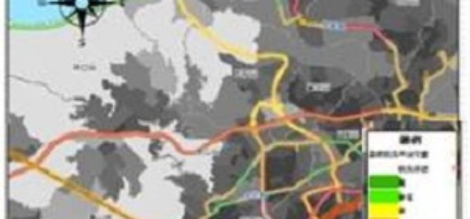
Climate Change Vulnerability Index System
To handle climate changes and reduce the loss of lives and properties, Taiwan government establishes a SuperGIS-powered platform, to provide latest information to support decision making. To address climate changes
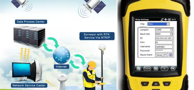
SuperPad Reveals NTRIP Solution to Achieve Centimeter Level Accuracy
Supergeo, the leading GIS software and solution provider, is going to release NTRIP solution on its Windows Mobile GIS app, SuperPad, for high accurate field data collection and geospatial workflow
Supergeo Expand Partnership with Géo.RM, France
Supergeo Technologies, the global leading GIS software and solution provider, announced the renewal of SuperGIS software contract with Géo. RM, France. The extended collaboration will continue bringing French-speaking users the
Supergeo Renews Partnership with Star Vision for GIS Development in Southeast China
Supergeo Technologies, the global leading GIS software and solution provider, announced the extended partnership with Star Vision, the professional GIS consulting and surveying firm in Hong Kong, to further develop

High Accuracy and Advanced Field Work with Latest SuperSurv
To meet the great needs of high accuracy field data collection and better workflow via modern GNSS technology, Supergeo, the leading GIS software and solution provider, announces the latest SuperSurv
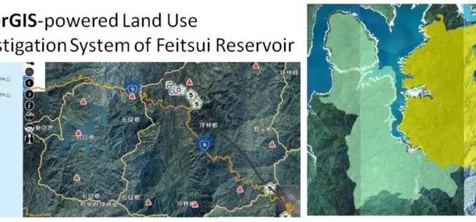
GIS Observation System Supplies Water for Lives
As the main water supply and electricity generator in great Taipei, Feitsui Reservoir is a vital resource in Taiwan. Feitsui Reservoir Administration therefore needs to ensure that water quality, water
Powerful GIS Web Manager in SuperGIS Server 3.2
Supergeo, the leading GIS software and solution provider, released the newest version of SuperGIS Server 3.2 to help enterprises share diverse geospatial data effortlessly. The latest SuperGIS Server 3.2 is
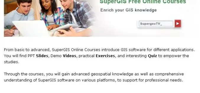
No-Cost Online GIS Courses on SupergeoTV to Enrich Geospatial Knowledge
To facilitate more GIS users and non-GIS professionals with deep understanding in geospatial technology, further applying GIS to diversified domains, Supergeo, the leading GIS solution provider, launches free online courses

Polytechnic University of Marche, Italy, Select SuperGIS for Geospatial Applications
The Polytechnic University of Marche, Italy (aka, UNIVPM) selects SuperGIS Desktop to build a professional teaching laboratory of engineering, environment observation and agriculture, to train outstanding geographic information personnel. Ranking
