
Tag "Landsat-8"
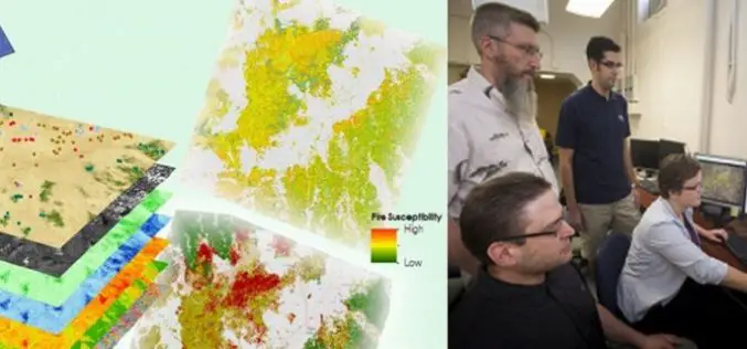
A Landsat based Tool to Map Wildfire Hazard and Susceptibility
Wildfires, coupled with the presence of invasive plant species, are primary drivers of change in semi-arid savanna ecosystems. These wildfires disrupt ecosystems, human localities, critical habitats of the endangered Greater
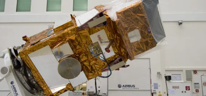
USGS Welcomes European Space Agencys New Land Observing Satellite
The U.S. Geological Survey salutes the European Space Agency (ESA) on the successful June 23 launch of its Sentinel-2A satellite, the second satellite to be launched in Europe’s Copernicus environment
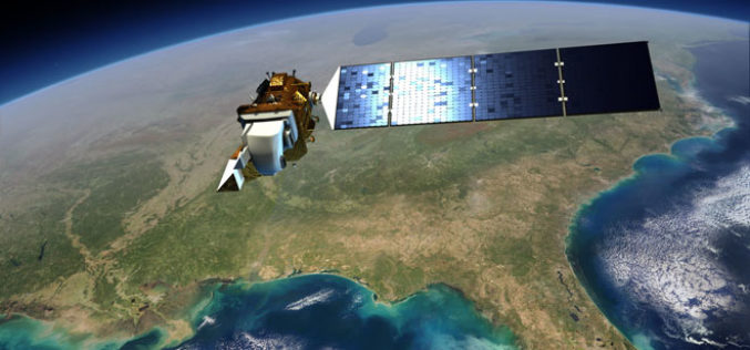
Landsat 9 to Continue Land Imaging Legacy of the U.S. Space Program
In recent news update by NASA, NASA and USGS are working together on Landsat 9, schedule to launch in 2023. NASA will build, launch, perform the initial check-out and commissioning

Download Free Landsat 8 Imagery from the Amazon Web Services Cloud
Amazon has announced the availability of Landsat on Amazon Web Services. Under this program, Amazon will host 1 petabyte of Landsat imagery from USGS on the Amazon Web Services Cloud. You

Webinar: Agricultural Monitoring Workflow Using Geomatica and Free Landsat-8 Imagery
Agricultural Monitoring Workflow Using Geomatica and Free Landsat-8 Imagery Freely available Landsat-8 imagery can be used as an initial no-cost pass to monitor agricultural crop health, in order to identify
Call for Papers: A Special Issue of Remote Sensing of Environment on Landsat 8 Science Results
With the launch of the Landsat Data Continuity Mission (LDCM) in February 2013, the already unprecedented Landsat global record continues and could reach 50 years or longer in length.

USGS-NASA Award Recognizes Innovations in Earth Observation
A pioneer in mapping global land cover change and the team behind the United States’ most advanced land surface mapping satellite have both been honored with the 2014 William T. Pecora
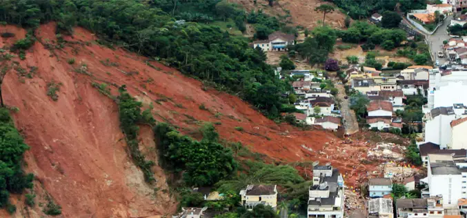
Seismic Signatures Signal Giant Landslide Alarm
In July 2013, researchers at Columbia University had an chance to test a landslide detection technique that uses signature long-wave seismic waves produced by large landslide to pick up the
New Landsat Data Just a Few Clicks Away From ESA
Thousands of never-before-seen data products from the US Landsat satellites acquired over 30 years have been released for online access. In addition, the newest data over Europe from the latest
