
Tag "remote sensing"

Modernizing Commercial Remote Sensing Regulation
Space News recently published my op-ed on the subject of regulatory reform for the U.S. commercial remote sensing industry. It lays out the case for why it is time for a major
Sustainable Land Utilization Modeling Using GIS and Remote Sensing
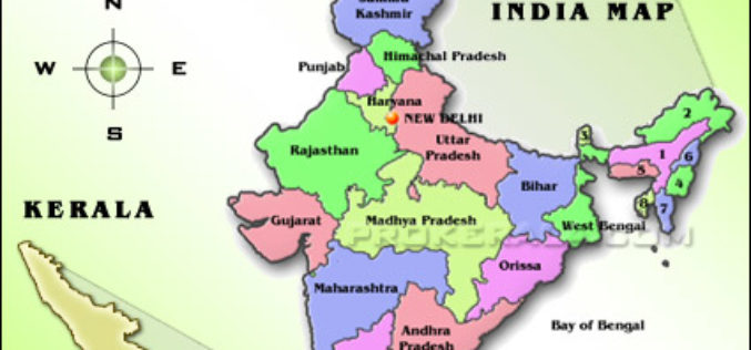
According to recent news published by The Hindu, The Kerala State Land Use Board (KSLUB) is gearing up to prepare a comprehensive data bank of resources coming under the Thiruvananthapuram

Training Course on GIS and Remote Sensing For Climate Change Impact Analysis and Adaptation
Training Course on GIS and Remote Sensing For Climate Change Impact Analysis and Adaptation October 10 – October 14, 2016 This training will offer a set of methods and techniques

NDMA Holds Meeting on Landslide Risk Management Strategy
ANI – The National Disaster Management Authority (NDMA) today called on a meeting to discuss the formulation of a National Landslide Risk Management Strategy. This was the first meeting of
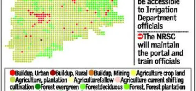
Telangana Goes for Geo-tagging With the Help of NRSC and ICRISAT
According to recent news by The Hindu, soon the citizens, farmers, administrators and policy makers can gain access to information about water availability and cropping pattern in all irrigation systems
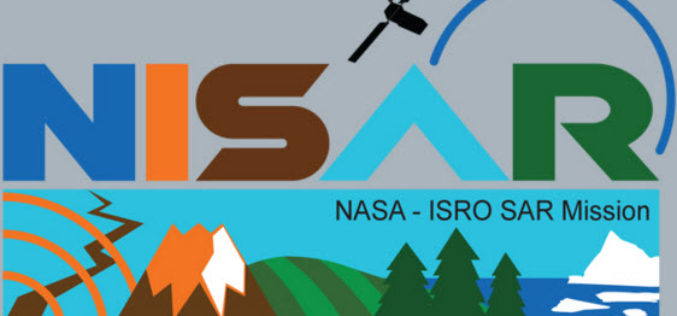
NISAR – NASA-ISRO Synthetic Aperture Radar Mission
According to recent by The Indian Express, the Indian Space Research Organisation (ISRO) and NASA’s Jet Propulsion Laboratory are jointly working on the development of a Dual Frequency (L&S band)
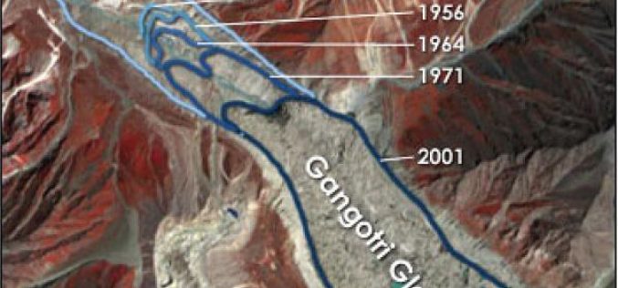
Remote Sensing Studies Reveals That Glaciers are Melting at 5 to 20 metre Rate Annually: India
New Delhi, Jul 19 (PTI) – Majority of glaciers in India including Gangotri are melting at varying rates ranging from five to 20 metre per year, the government today told
State Space Corporation ROSCOSMOS will Present Possibilities of Russian Remote Sensing System in November This Year in India
State Space Corporation ROSCOSMOS officially supports 16th International Scientific and Technical Conference “FROM IMAGERY TO MAP: digital photogrammetric technologies” which will be held from 14 till 17 November, 2016 in

DigitalGlobe to Announce Second Quarter Financial Results on July 28, 2016
WESTMINSTER, Colo.–(BUSINESS WIRE)–Jul. 14, 2016– DigitalGlobe, Inc. (NYSE: DGI), a leading global provider of commercial high-resolution earth observation and advanced geospatial solutions, will announce its second quarter 2016 financial results
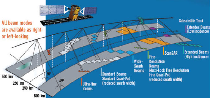
EMSA Expands Use of RADARSAT-2 Information for Maritime Applications
Richmond, BC – MacDonald, Dettwiler and Associates Ltd. (“MDA” or the “Company”) (TSX: MDA), a global communications and information company, has recently (July 13, 2016) announced that it has signed
