
Tag "remote sensing"

Training Course on GIS and Remote Sensing in Multi-hazard Early Warning Systems
Training Course on GIS and remote sensing in multi-hazard early warning systems July 25 – July 29 This training aims to develop the capacity of professionals mainly working in Disaster
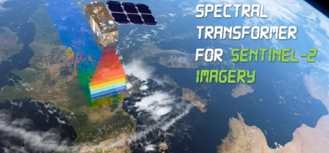
Spectral Transformer for Sentinel-2 Imagery Just Released
In a recent update, GeoSage has just released a software tool for the ESA’s 10m-resolution Sentinel-2 imagery. As many of you already know, the Sentinel-2 satellite is equipped with even more
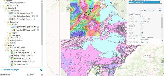
Botswana Geoscience Portal Goes Live
Online portal improves access to geoscience data from Africa Geosoft recently announced the launch of the Botswana Geoscience Portal, a partnership initiative with the Botswana Geoscience Institute and industry sponsors. Developed

China Releases Remote Sensing Data for Environment Protection
BEIJING, June 6 (Xinhua) — China released a remote sensing report on Monday, detailing ecological information related to land cover, vegetation, agricultural conditions and marine environment on a global scale.

World View and Ball Aerospace To Jointly Explore Stratollite Platform for Remote Sensing Applications
Broomfield, CO – June 2, 2016 – World View, pioneers of the stratosphere, are collaborating with Ball Aerospace to explore World View’s Stratollite platform for remote sensing applications. Ball Aerospace
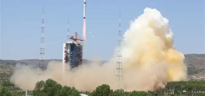
China Launches New High-resolution Satellite for Civilian Mapping
IANS – China on Monday launched a new civilian high-resolution mapping satellite from the Taiyuan Satellite Launch Centre in Shanxi province. The 2.7-tonne Ziyuan III 02 satellite soared on the back

Royal Society Funded PhD Studentship: Remote Sensing to Assess and Monitor Funding Conditions
Swansea University is a research-led university that has been making a difference since 1920. The University community thrives on exploration and discovery, and offers the right balance of excellent teaching
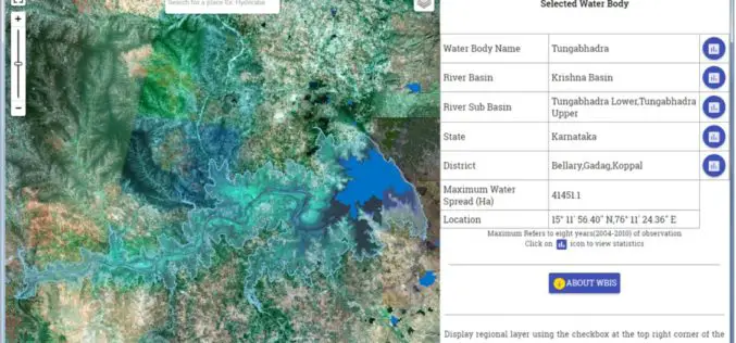
Temporal Repetitive Mapping of Water Bodies Across India
National Remote Sensing Centre (NRSC), ISRO at Hyderabad monitors the status of all the water bodies in the country using satellite images and provides water spread area information on a
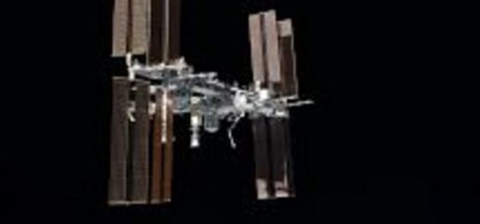
“India Should Build Its Own Space Station”
India should actively get into building its own space station in the Low Earth Orbit (LEO) as its next space frontier since the time is opportune for this, a retired
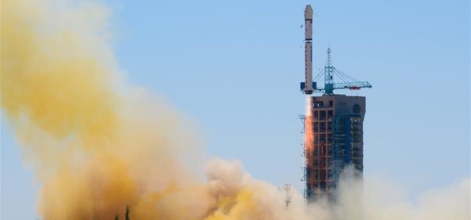
China Launches Yaogan-30 Remote Sensing Satellite
According to recent news by Xinhua, China has successfully launched Yaogan-30 remote sensing satellite into space. The spacecraft lifted off at 10:43 a.m. local time Sunday, May 15 (10:43 p.m. EDT
