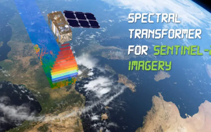
In a recent update, GeoSage has just released a software tool for the ESA’s 10m-resolution Sentinel-2 imagery.
As many of you already know, the Sentinel-2 satellite is equipped with even more powerful imaging features than Landsat-8: finer and sharper spatial resolution, more multispectral bands, and higher revisit frequency. The satellite was launched last June, and over the past half year, access to this great imagery source has become much easier. We feel the timing is right to develop and release this software.
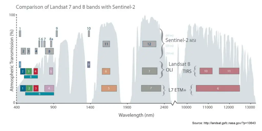
Comparison of spectral bands between Sentinel-2 and Landsat-8 (the “cousins”): (Source: NASA)
Very recently, large and new companies (e.g. Google, DigitalGlobe, Planet Labs and Urthecast) are making efforts to develop cloud-based platforms for processing a massive amount of Earth imagery towards the global level. But for the majority of image analysts, the main approach for detailed image classification and interpretation is still traditionally desktop-based, along with domain-specific ground knowledge necessary for accuracy assessment and outcome validations.
The ESA is developing and distributing Sentinel-2 Toolbox for Sentinel-2 image processing. The latest Version 3.0 is a ~350 MB download.
Spectral Transformer for Sentinel-2 Imagery is a dedicated software tool that promises an easy and rapid processing of Sentinel-2 imagery for both geospatial professionals and general users. Unique features on image stretching, image fusion, exploratory feature extraction and batch processing are included in a simple workflow. It performs most common and important image analysis steps:
- Step 1 – Band combination (to make three-band imagery composite)
- Step 2 – Image histogram stretching (to make colourful composite)
- Step 3 – Image pan-sharpening (to make colourful and spatially sharper composite)
- Step 4 – Exploratory image feature extraction with image feature indices (e.g. NDVI and NDWI) and band ratios
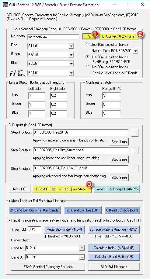
Sentinel-2 Toolbox GUI. Source: GeoSage
Advantages of Spectral Transformer for Sentinel-2 Imagery”
Advanced software to easily and rapidly make colourful and detail-rich (10m-resolution) Sentinel-2 imagery composite, with a few simple button clicks.
- For geospatial professionals and general users. It is productive and saves time!
- Functions include band combinations, image stretching, image pan-sharpening, and exploratory image feature extraction. Perfect software tool to get the daily fresh Sentinel-2 imagery into GIS and remote sensing software, and Google Earth Pro.
- Version 2.0 released in June 2016
Detailed methods are introduced in the software User Guide (PDF file).