
Tag "remote sensing"
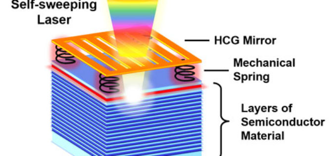
Self-Sweeping LiDAR Could Dramatically Shrink 3D Mapping Systems
A team of UC Berkeley engineers led by Connie Chang-Hasnain, a professor of electrical engineering and computer sciences, used a novel concept to automate the way a light source changes
India to Launch Multi-Spectral Remote Sensing Indonesian Satellite
Kuala Lumpur: India will launch a second multi-spectral remote sensing Indonesian satellite that will help the country to monitor land-use, natural resource and in disaster mitigation. The indigenously-made LAPAN A2/Orari
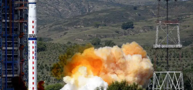
China Launches Yaogan-27 Earth Observation Satellite
According to CRIEnglish.com, China has successfully launched the Yaogan-27 remote sensing satellite into a scheduled orbit at 10:31 a.m. Beijing Time on Aug. 27,2015 from Taiyuan launch site in Shanxi Province, north
Belarus, Russia Sign Agreement to Develop Remote Sensing Satellite
The Russian corporation VNIIEM and the National Academy of Sciences of Belarus (NASB) signed an agreement on developing and operating a satellite for the high-resolution remote sensing of the Earth.

ARSET Training Announcement: Remote Sensing for Wildfire Applications
Remote Sensing for Wildfire Applications (in-person workshop) October 6-8, 2015 Idaho State University, Pocatello, Idaho, USA Workshop Overview: The ARSET team is gearing up for an in-person training titled “Remote
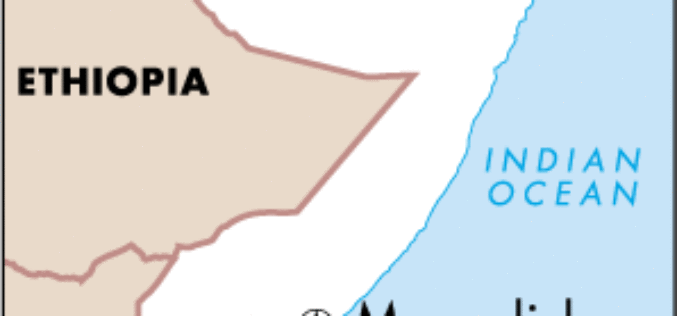
Remote sensing, Satellite Imagery, Surveys Use to Estimate Population of Mogadishu
The results of the first population survey of Mogadishu, Somalia, conducted in a quarter century were presented today at a session of the 2015 Joint Statistical Meetings (JSM 2015) in
176 Flood Forecasting Stations Established Across India
As many as 176 flood forecasting stations have been set up across the country where predictions are made during every monsoon whenever the water level exceeds limits, Water Resources Minister

Eyes in the Sky to Protect World Heritage Angkor Wat
As reported in Xinhua, China signed a MoU with HIST (UNESCO) to use remote sensing technology to provide a new level of protection for the ruins of Cambodia’s Angkor Wat, the

Satellite Remote Sensing of Particulate Matter Air Quality: Data, Tools, Methods and Applications
Satellite Remote Sensing of Particulate Matter Air Quality: Data, Tools, Methods and Applications (aka AOD-PM) October 1 – October 29, 2015 5 webinars: one hour per week Every Thursday 11:30

China to Open Doors for Commercial Remote Sensing Satellite
BEIJING: A Chinese province, one of the communist nations oldest industrial bases, plans to launch its first indigenous remote sensing satellite for commercial use in October. Northeast China’s Jilin Province
