
Tag "remote sensing"

Mumbai Goes for Mangrove Mapping and Monitoring
The Maharashtra state mangrove cell and Maharashtra Remote Sensing and Space Application Centre (MRSAC) will begin an individual assessment of mangroves in Mumbai, Navi Mumbai and Thane. The study will

PhD in Integrated Remote Sensing and Numerical Forecasting at CIRFA
The “Centre for Integrated Remote Sensing and Forecasting for Arctic Operations (CIRFA)” will contribute with research on methods and technologies that can reliably detect, monitor, integrate and interpret multi-sensor data describing
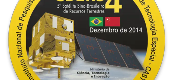
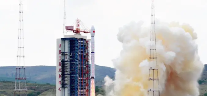
CBERS 4, Remote Sensing Satellite Jointly Developed by Brazil and China
CBERS 4, developed by the China Academy of Space Technology and Brazil’s National Institute for Space Research, the CBERS 4 was sent into Sun-synchronous orbit by a Long March 4B

New GeoDigital Vegetation Management Calculator Estimates over $1 Billion in Savings for North American Utilities
By moving from human to digital inspections utilities in North America can conservatively save $1 billion, reduce risk of vegetation-related outages whilst improving efficiency, safety and enabling compliance GeoDigital, a
ISPRS Releases The International Archives of the Photogrammetry, Remote Sensing and Spatial Information Sciences
The International Archives of the Photogrammetry, Remote Sensing and Spatial Information Sciences is the series of proceedings published by the International Society of Photogrammetry and Remote Sensing (ISPRS). The Archives

European Union and China Have Signed a Research Deal on Remote Sensing
European Union and China have signed a new collaborative research arrangement in the area of remote sensing. The deal, which emerged during the Europe-China summit, involves Europe’s Joint Research Centre (JRC) and

PCI Geomatics Launches Customer Support Website
MARKHAM, Ontario, Canada—June 30, 2015: PCI Geomatics, a world leading developer of remote sensing and photogrammetric software and systems, announced today that it launched a dedicated customer support website at

NASA Air Quality Remote Sensing Training for SESARM & GEPD
The goal of the NASA Applied Remote Sensing Training (ARSET) is to increase the utility of NASA earth science and model data for policy makers, regulatory agencies, and other applied
China Launches Gaofen 8 Earth Observation Satellite
In recent news, China has successfully launched the Gaofen 8, a high resolution optical remote sensing satellite into a scheduled near-circular orbit with an average altitude of around 473 kilometers, or
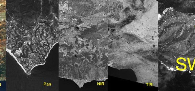
Why SWIR Band in Remote Sensing?
Each object has its own spectral signature, which is also the basic principle of remote sensing. Today we have satellites with various sensors collecting data in Visible light, Near Infrared (NIR),
