
Tag "USGS"
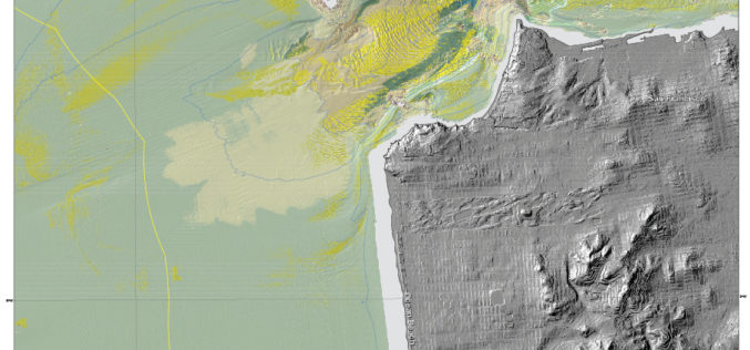
New Maps Reveal Seafloor off San Francisco Area
SANTA CRUZ, Calif. — Three new sets of maps detail the offshore bathymetry, habitats, geology and submarine environment of the seafloor off the coast of San Francisco, Drakes Bay, and

USGS Continues to Write History
New Volume of Agency Annals Released The fourth volume of the comprehensive history of the U.S. Geological Survey, Minerals, Lands, and Geology for the Common Defence and General Welfare: Volume
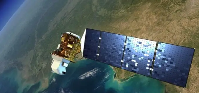
Landsat 9 to Continue Land Imaging Legacy of the U.S. Space Program
In recent news update by NASA, NASA and USGS are working together on Landsat 9, schedule to launch in 2023. NASA will build, launch, perform the initial check-out and commissioning
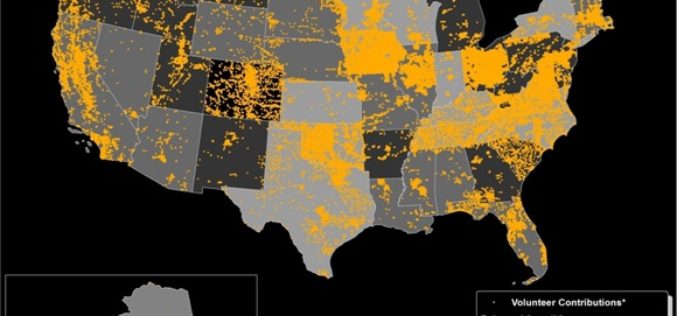
Do You Like to Map? Take the Mapping Challenge!
The USGS crowd-sourcing project volunteers have updated all law enforcement points in Tennessee Volunteer citizen-mappers continue to make significant contributions to the USGS ability to provide accurate mapping information to

Some Coastal Communities May Not Have Time for Tsunami Evacuation
Tens of thousands of people along the U.S. Pacific Northwest coastline may not have enough time to evacuate low-lying areas before tsunami waves arrive, according to a new publication by

New National Geospatial Program Director Announced
The U.S. Geological Survey is pleased to announce the selection of Michael Tischler to the position of the Director, National Geospatial Program (NGP), starting Monday, April 6th. Mike brings a
Newly Released US Topo Maps for California Now Feature Selected Trails
Newly released US Topo maps for California now feature selected trails and other substantial updates Several of the 2,798 new US Topo quadrangles for California now display public trails along

Download Free Landsat 8 Imagery from the Amazon Web Services Cloud
Amazon has announced the availability of Landsat on Amazon Web Services. Under this program, Amazon will host 1 petabyte of Landsat imagery from USGS on the Amazon Web Services Cloud. You
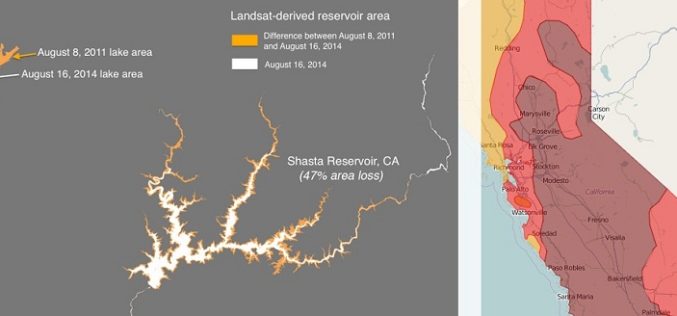
Drought Monitoring and Visualization with Open Data
Drought is condition when a region notes a deficiency in its water supply whether surface or underground water. A drought can last for months or years, or may be declared after
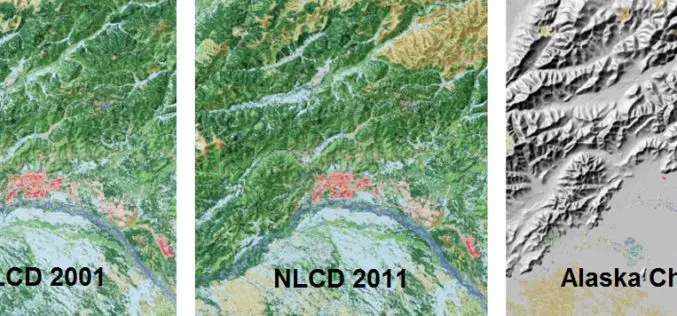
A Decade of Change in America’s Arctic: New Land Cover Data Released for Alaska
The latest edition of the National Land Cover Dataset (NLCD 2011) for Alaska is now publicly available. The extensive NLCD database continues to add to our understanding of where land
