
Archive

China Released New Regulations on Maps to Boost Geographic Information Industry
China has released new regulations on maps to boost development of the geographic information industry. The new regulations includes, a new chapter on online map services, as well as new
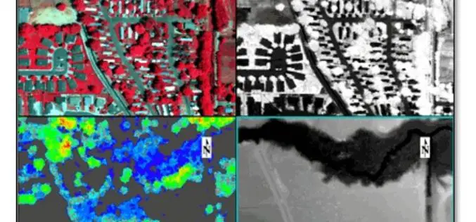
LiDAR and Hyperspectral Data Fusion
We all in the geospatial domain have heard about data fusion/image fusion, a technique or way of combining the spectral information of a coarse-resolution image with the spatial resolution of
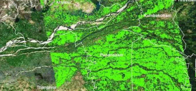
Researchers from TNAU Uses Satellite Images for Crop Management
According to recent news by The Hindu, researchers from Tamil Nadu Agricultural University (TNAU), Coimbatore, have calculated how much-cultivated area was inundated in the recent rains hit hard the costal
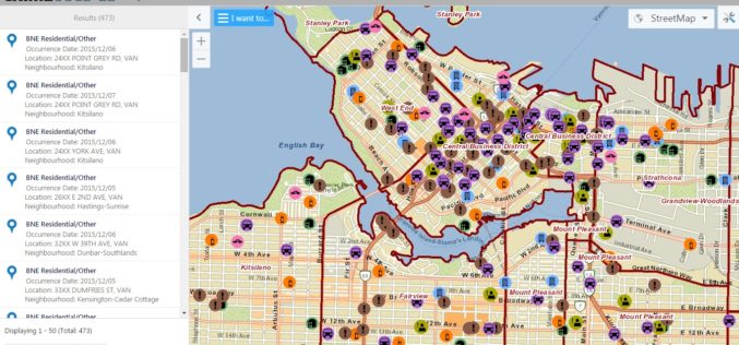
Vancouver Police Department Launch Crime Mapping Tool
The Vancouver Police Department (VPD) has launched a public version of an interactive crime mapping tool called GeoDASH, which officers have been using for about a year now. GeoDASH stands for
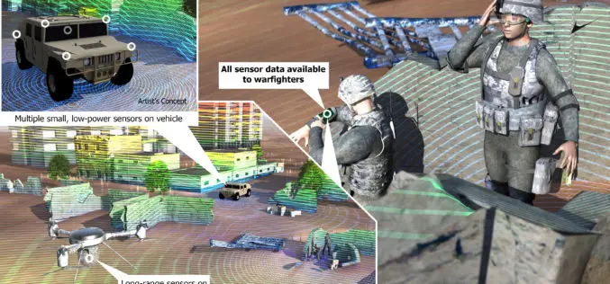
DARPA to Develop Ultracompact LIDAR Systems
Defence Advanced Research Projects Agency (DARPA) lighter and cheaper technology to replace a large, heavy and expensive light detection and ranging (LIDAR) systems. The primary goal of the newly-announced Modular Optical Aperture Building

Creating a collaborative Laser Scanning Workflow in Real-time for BIM and Beyond
Webinar: Creating a collaborative Laser Scanning Workflow in Real-time for BIM and Beyond December 14, 2015 -December 14, 2015 Laser scanning and volume data provides the mechanism to bring the
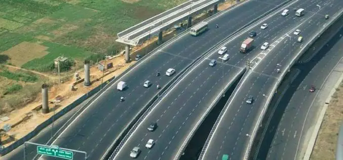
NHAI to Use Satellites for Road Mapping
According to recent news, the Central Road Research Institute (CRRI) has developed several technologies/procedures/methods for construction and maintenance of Indian roads such as cold mix & warm mix technologies for
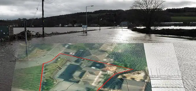
Bluesky’s 3D Aerial Maps Inform Flood Risk Assessments for Planning Applications
Aerial photography and detailed 3D height models are being used to assess the risk of flooding, and help development projects progress through the planning process. Working with Betts Hydro, part
SuperGIS Desktop Supports Italian Waste Management Organization
The global GIS solution and software provider, Supergeo Technologies Inc. announces that ATO2 – Ancona, a regional waste management organization in Italy, has selected SuperGIS Desktop as their solution to

ISRO Has Launched Remote Sensing Satellites in Thematic Series, Says Jitendra Singh
New Delhi, India Dec. 9: Union Minister of State for Space Jitendra Singh on Wednesday informed the Lok Sabha that Indian Space Research Organisation (ISRO) has launched Remote Sensing Satellites
