
LiDAR

Introducing Polaris – Next-Generation Terrestrial Laser Scanner
Teledyne Optech to showcase its newest and most advanced TLS at SPAR 3D March 22, 2017 — Teledyne Optech is pleased to announce the release of its Polaris Terrestrial Laser
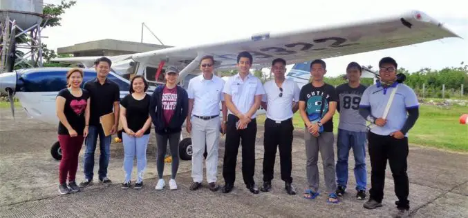
Aerial LiDAR Survey to Produce 3D Flood and Hazard Maps for River System in Philippines
Catandunganon, Philippines – Recently a team from the Department of Science and Technology (DOST) and the University of the Philippines Training Center for Applied Geodesy and Photogrammetry (UP TCAGP) has conducted
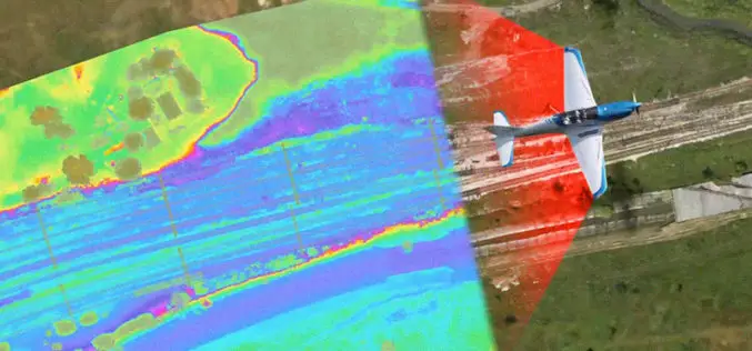
Aerial LiDAR Survey of Rail Corridor Between Mumbai and Ahmedabad
According to recent news reported by TOI, The railways will use LiDAR technology -aerial survey using a chopper -to speed up work on India’s first high-speed train corridor between Mumbai

Airborne LiDAR to Throw Light on Rajgir Hill’s History
Kolkata,Nov 7, 2016- IANS – Indian archaeologists plan to deploy high-end scanning lasers on airborne platforms to survey the archaeological evidence, flora and fauna in the ancient Rajgir hills in
NOAA Offers LiDAR Coastal Mapping Training
The National Oceanic and Atmospheric Administration (NOAA) has launched a self-paced, 80-minute online training introducing several fundamental concepts of LiDAR to help you get more out of your LiDAR point cloud data. The

LiDAR Technology for Monitoring Bridge Structure Defect and Health
Road infrastructure of a country plays a crucial role in the national economy. Among all road infrastructure, Bridges are one of the vital assets and histories has given us various evidence
Put Your LiDAR Data on the GIS Platform!
By rapidly collecting massive data from the surface, LiDAR technology has dramatically changed the geospatial industry. LiDAR data can record much information delicately such as the elevation, the spectrum, and
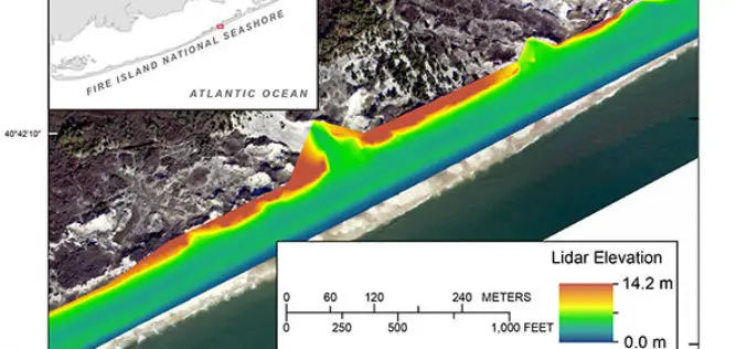
Terrestrial-based Lidar Beach Topography of Fire Island, New York
Abstract: The U.S. Geological Survey (USGS) St. Petersburg Coastal and Marine Science Center (SPCMSC) in Florida and the USGS Lower Mississippi-Gulf Water Science Center (LMG WSC) in Montgomery, Alabama, collaborated to
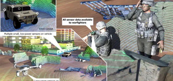
DARPA to Develop Ultracompact LIDAR Systems
Defence Advanced Research Projects Agency (DARPA) lighter and cheaper technology to replace a large, heavy and expensive light detection and ranging (LIDAR) systems. The primary goal of the newly-announced Modular Optical Aperture Building
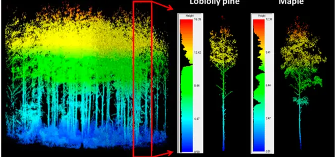
LiDAR Scanning Can Help Identify Structurally Heterogeneous Forest Areas
The inequality of tree sizes in a forest is an important factor affecting its structure and ecology. Forest management practices favouring natural regeneration can result in greater heterogeneity and complexity
