
Tag "3D"

RIEGL’s Ultimate LiDAR Technology New Products Launch at INTERGEO 2024
RIEGL’s Ultimate LiDARTM Technology offers a wide range of performance characteristics and serves as a platform for continuing Innovation in 3D for the LiDAR industry. New products, that will be

How Digital Twin for Housing is Transforming Home Selection in Abu Dhabi
The Abu Dhabi Housing Authority (ADHA) is pioneering a significant technological leap with the adoption of digital twin technology for housing. This innovative approach focuses on creating a highly interactive
LiDAR in Traffic Management: UDOT’s Plan for Safer Intersections
The Utah Department of Transportation (UDOT) is spearheading an innovative project that leverages LiDAR in traffic management to enhance safety and efficiency at key intersections. Launched in March 2024, this

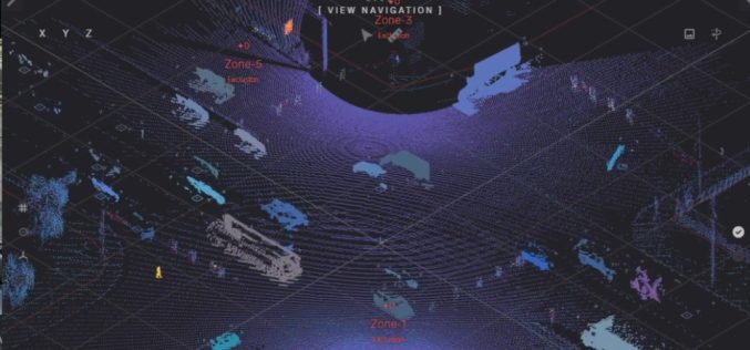
Euclideon Expands to Include Bespoke 3D Geospatial Visualisation Solutions as the Industry Metaverse Rapidly Grows to Meet New Demands
The Geospatial Services market is expected to reach $215 billion by 2027, at a CAGR of 16.9% from 2020 to 2027.* The introduction of sophisticated tools such as 3D tools,

Pix4D Launches in the USA and Canada, the viDoc RTK rover, an iPhone Case that Enables Handheld Professional 3D Scanning
Pix4D, the market leader in photogrammetry solutions, has just made the viDoc RTK rover available for purchase in the USA and Canada. Already available in Europe, the German-designed rover attaches

Intermap and TATA Communications Signed Agreement for 5G Network
Initially Intermap will support TATA’s expansion of its 5G network in selected Indian cities.

Pix4D Launches New Ground Image Capture App for 3D Modeling With the iPad Pro and iPhone 12 Pro
Pix4D, the photogrammetry industry leader, announces today the release of a new app product for ground images acquisition: Pix4Dcatch. Pix4Dcatch empowers users to easily create ground-based 3D models using an
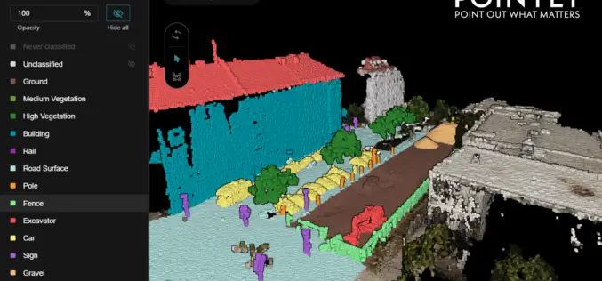
Pointly – Next Level 3D Point Cloud Classification Tool Launched
Supper & Supper has launched Pointly, the solution enabling accelerated manual 3D point cloud classification using innovative AI techniques.
Hexagon Geospatial Releases M.App X 2020 Update 1 – Cloud-based Enterprise Solution for Imagery Intelligence
Hexagon Geospatial has recently released M.App X 2020 Update 1 with great new features. The major version of M.App X 2020 was released late in January 2020. M.App X is a
Orbit GT Upgrades 3D Mapping Cloud to Support Meshes, DEMs
“I’m pleased to announce yet another great update for our popular SaaS platform from the Smart City Expo and World Congress in Barcelona”, says Peter Bonne, CEO of Orbit GT.
