
Tag "ArcGIS alternative"
SuperGIS is Selected for Public Infrastructure in Nepal
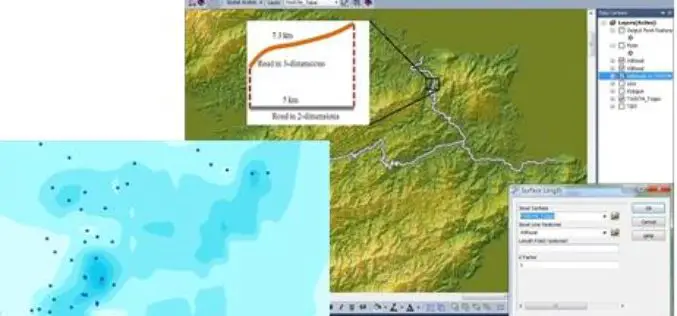
Supergeo Technologies, the global leading GIS software and solution provider, announces that Rajdevi Engineering Consultant utilizes SuperGIS Desktop, SuperGIS Spatial Analyst and SuperGIS 3D Analyst in several governmental public infrastructure
Tag at Hot Tourist Spots with GIS
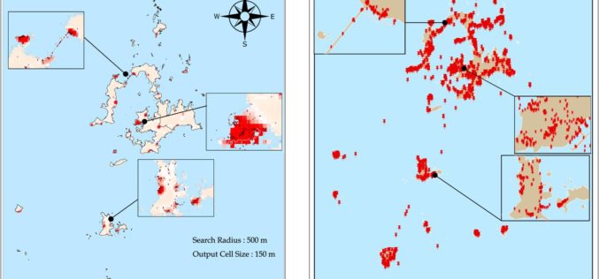
Tourism management is highly relevant with locations, so GIS is useful to find out better solutions. However, traditional research consumes a lot of time on data collecting, and is limited
Various APIs in SuperGIS Server 3.2 Improve Customization Flexibility
Supergeo Technologies, the global leading GIS software and solution provider, releases rich JavaScript APIs (Application Programming Interface) to assist SuperGIS Server 3.2 users in customizing plentiful and intuitive map websites.

SuperGIS Supports Orienteering Club Charity Map Projects
Supergeo Technologies, the global leading GIS software and solution provider, announces that Star Vision Ltd., Supergeo Certified Reseller in Hong Kong, Macau and Guangdong, utilizes SuperGIS in a charity map
Get the Hang of latest SuperGIS Desktop 3.2
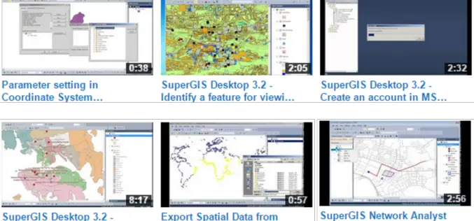
Supergeo Technologies Inc., the global leading GIS software and solution provider, released new Product Demo Videos on Supergeo TV Channel to demonstrate most frequently-used functions in latest SuperGIS
SuperGIS Assists Talented Youth in Winning Geography Olympiad Champion
Supergeo Technologies, the global leading GIS software and solution provider, announce that SuperGIS was chosen in Taiwan Geographic Olympiad 2014 and helped the participants win the first award. The winners
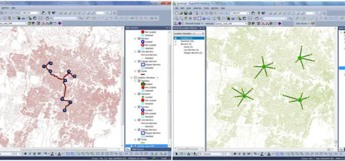
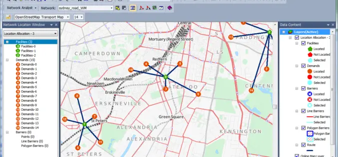
Supergeo Launches the Newest SuperGIS Network Analyst 3.2
Supergeo Technologies Inc., the global leading GIS software and solution provider, launches the newest SuperGIS Network Analyst 3.2 with stronger analysis performance and computing methods. SuperGIS Network Analyst 3.2 enables
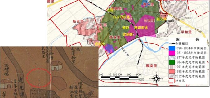
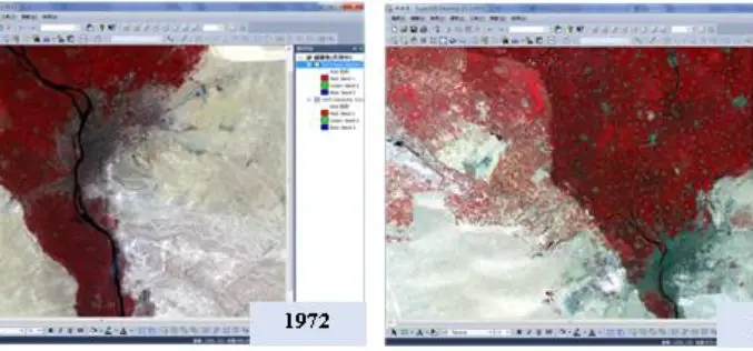
GIS Reappear Historical Township Maps
To better understand historical geospatial relations and complete the shortage of traditional historiography, which usually only uses textual materials, GIS technologies provide historians with modern method to rebuild the historical
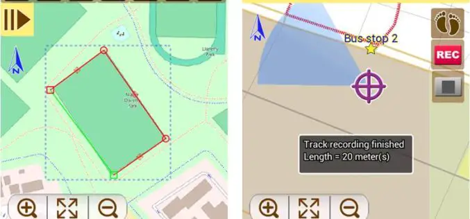
Latest SuperSurv 3.2 Boosts Convenience of Geospatial Data Collection
Developed by Supergeo, the latest version of SuperSurv (iOS/Android) 3.2 is upgraded with more global coordinates systems functions to bring users a more convenient and intuitive manipulation. SuperSurv, the mobile
Supergeo Releases SuperGIS Spatial Analyst 3.2
Supergeo Technologies, the global leading GIS software and solution provider, releases the latest SuperGIS Spatial Analyst 3.2 for worldwide SuperGIS Desktop 3.2 users to experience more advanced spatial analysis functions.
