
Tag "Bhuvan"
Join Free Training on Bhuvan – Gateway to Geospatial World
Training on Bhuvan – Gateway to Geospatial World December 08 – 09, 2015 Bhuvan, (lit: Earth), is a software application which allows users to explore a 2D/3D representation of the

Satellite Mapping of National Highways
In recent news by Business Standard, the National Highways Authority of India (NHAI) is planning to sign a memorandum of understanding (MoU) with the Indian Space Research Organisation (ISRO) to adopt
4Dmapper to Store, Deliver and to Share Geospatial Data
4Dmapper is a web based geospatial product. If you are thinking that it is same as Google Earth or Bhuvan; NO, 4Dmapper is a rich, purely browser based 3D environment
Bhuvan Bhujal Portal – Ground Water Prospects Information System
The National Remote Sensing and Application Centre (NRSC), India has recently launched a web application “Bhujal Portal”. Bhujal is sponsored project by Department of Drinking Water and Sanitation, Ministry of Drinking
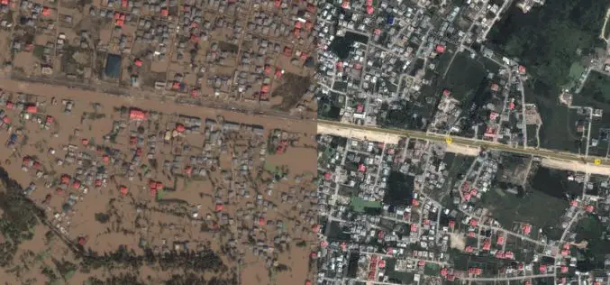
Kashmir Floods Monitored By Latest Satellite Technology
Union Minister Jitendra Singh said that Kashmir floods are being constantly monitored by latest satellite technology at the National Remote Sensing Centre. “Kashmir floods are being constantly monitored by latest
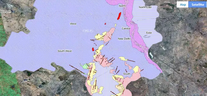
ISRO Empowering Panchayati Raj Institutions using Bhuvan Panchayats
Bhuvan Panchayats Portal plays an important role to disseminate the deliverables of the project including High Resolution Satellite Imagery and Resource Maps at 1: 10,000 scale, to the three levels
NRSC has Launched Plug-in Independent Bhuvan 3D
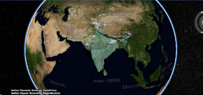
Bhuvan: A Gateway to Indian Earth Observation,is a web based software enabled application to explore earth in 2D and 3D. Bhuvan was developed by National Remote Sensing Centre (NRSC), Hyderabad, India. Bhuvan is
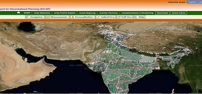
Bhuvan Updates: Gateway to Indian Earth Observation
On the occasion of NRSC User Interaction Meet – 2014, Bhuvan has been enriched with several features, data products and Services. Bhuvan 2.5D Bhuvan now brings 2.5 D City Models
