
Tag "China"
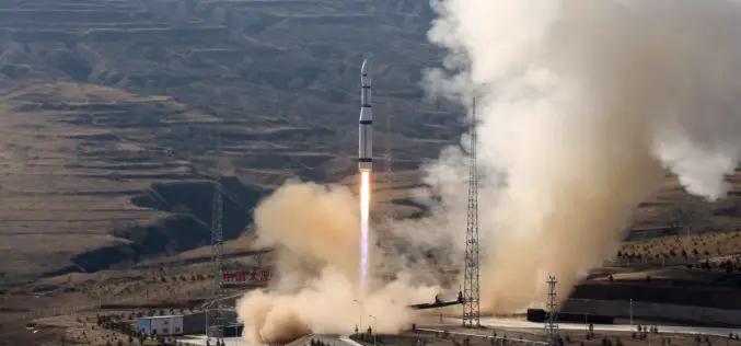
China Launches Three Remote Sensing Satellites – Jilin-1-04, Jilin-1-05 and Jilin-1-06
November 21 (ANI): China has launched three remote sensing satellites to promote commercial use for the remote sensing industry. The satellites — Jilin-1-04, Jilin-1-05, and Jilin-1-06 — were carried by a
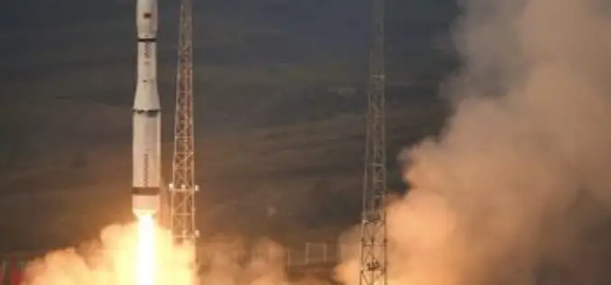
Launch of China’s New-Generation Beidou-3 Navigation Satellites
November 5, 2017 – According to recent news, China has successfully launched two navigation satellites – namely the Beidou-3M1 (Beidou-24) and Beidou-3M2 (Beidou-25) navigation satellite using a Long March-3B/YZ-1 rocket. The satellites are
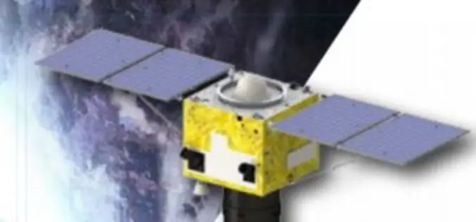
China Launched the 2nd Remote Sensing Satellite for Venezuela
According to recent news reported by Sputnik, China launched the second Venezuela Remote Sensing Satellite (VRSS-2) using a Long March-2D (Chang Zheng-2D) launch vehicle on October 09, 2017. Also known by

China, Russia to Sign Agreement to Boost Space Cooperation
Beijing, Aug 28 (IANS): China and Russia are set to sign a milestone agreement on joint space exploration from 2018 to 2022, the media reported on Monday. The deal is expected

China Adopts Revised Surveying and Mapping Law – Protecting National Security & Raising Public Awareness
China – April 28, 2017 – China’s top legislature Thursday passed a revised surveying and mapping law, protecting geographic information security and raising public awareness of national territory. The legislation
China Unveils Results of First National Geoinformation Survey
China boasts a total of 7.56 million square kilometers of vegetation cover, while buildings cover 153,000 square kilometers of land, the State Council Information Office unveiled at a news briefing
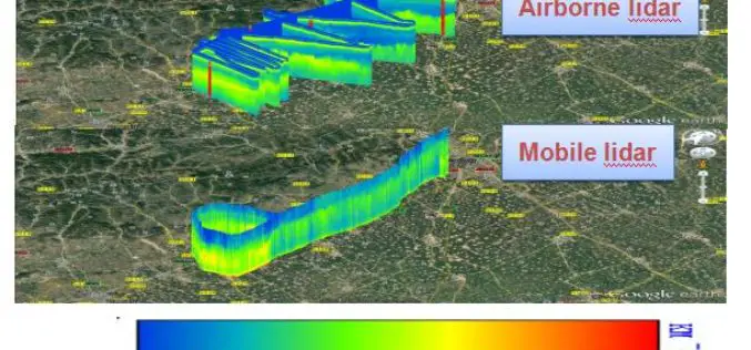
AIOFM’s Rapid Online Monitoring LiDAR System Steps into Its Industrialization
With support from special project of national major scientific apparatus “R&D and Application of LIDAR System for Spatial-Temporal Detection of Atmospheric Fine Particle and Ozone”, Anhui Institute of Optics and
China Launches SuperView-1 Duo High-resolution Remote Sensing Satellites
December 28, 2016 – China today successfully launched a pair of high-resolution remote sensing satellites to get commercial images. The satellites were launched today from the Taiyuan Satellite Launch Centre in

China Made Venezuela and Pakistan Remote Sensing Satellite Launch in 2018
According to recent news by the Business Recorder, China Great Wall Industry Corp, the nation’s only authorized firm for international space collaboration, will launch Venezuela’s second remote sensing satellite next
China Developing Water Cycle Observation Satellite to Monitor Hydrological Events
According to recent news by PTI, China will launch its first geoscientific satellite by 2020 for forecasting hydrological events, including floods and droughts. China announced its plans for the Water
