
Tag "Geospatial Technology"

A High-Accuracy Solution for Forest Management
SuperGIS Webinar: A High-Accuracy Solution for Forest Management Wednesday, 17th August 10:00 AM (GMT+2) Your local time Geospatial technology is changing how everything works, including industries with a long history such

Are you building the next Pokemon Go? Apply to Geovation now to secure funding for your GeoTech start-up
Geovation, an Ordnance Survey (OS) initiative supporting corporations, SMEs, start-ups and individuals using geospatial technology and data to create innovative new products and services, invites applications for the next batch of
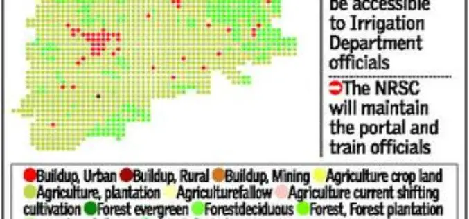
Telangana Goes for Geo-tagging With the Help of NRSC and ICRISAT
According to recent news by The Hindu, soon the citizens, farmers, administrators and policy makers can gain access to information about water availability and cropping pattern in all irrigation systems

Two UN Agencies Adopted Geospatial Technologies to Protect Cultural Heritage
Two United Nations agencies (UNOSAT and UNITAR) have signed an agreement to protect cultural and natural heritage sites by using the latest geospatial technologies, including a satellite imaging system. The

Unleash Agri-Production With Geospatial Technology
Contributed By:- “Food security exists when all people, at all times, have physical, social and economic access to sufficient, safe and nutritious food that meets their dietary needs and food
ISRO to Monitor Water Bodies in Tribal Areas Using Geospatial Technology
New Delhi – In a first, ISRO’s National Remote Sensing Centre (NRSC) will monitor and map the water bodies in tribal belts in the country to help tackle irrigation crisis
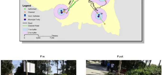
ISRO Utilizes Geospatial Technology for Swachh Bharat Abhiyaan
A novel initiative to contribute in the Swachh Bharat Abhiyaan using the Geospatial Technology (GST) was taken up jointly by the central Government institutions in Dehradun. This initiative was supported
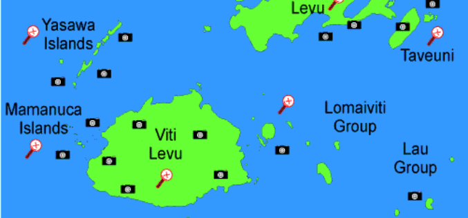
Fiji Government Assures its Commitment to Support Geospatial Industry
The Fijian Government has remained committed to the wide-spread use of geospatial technologies and to bringing Fiji’s existing technologies in line with international standards. Those were the sentiments of Prime

India Proposes Use of Geospatial Technologies to Strengthening Mutual Cooperation between BRICS Nations
The Minister for Science, Technology and Earth Sciences, Dr. Harsh Vardhan is leading an Indian delegation to the 3rd BRICS Ministerial Meeting on Science, Technology and Innovation (STI) being held
Geospatial Technology to Assist Centre in ‘Housing for All’ Mission
New Delhi, Housing and Urban Poverty Alleviation Ministry has joined hands with National Remote Sensing Center, Hyderabad, for use of latest technologies in its Housing for All urban mission, on the
