
Tag "Machine Learning"
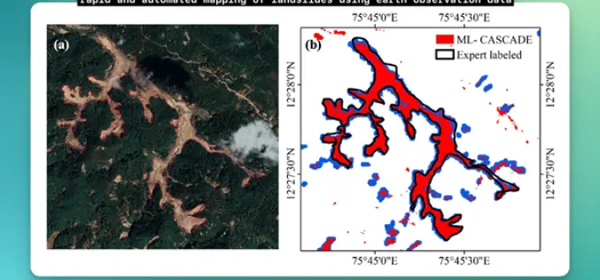
IIT Delhi Develops Tool for Automated Mapping of Landslide Events
Researchers from the Civil Engineering Department at IIT Delhi have introduced a groundbreaking tool, ML-CASCADE, aimed at Automated Mapping of Landslide extents using satellite data. This cloud-based machine learning tool
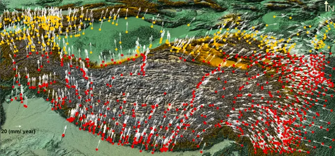
Enhancing Tectonic Studies with Machine Learning For Crustal Velocity Prediction
Crustal deformation is a critical area of study, especially in tectonically active regions like the Tibetan Plateau. In their research, Bappa Mukherjee, et. al. present a novel approach using machine
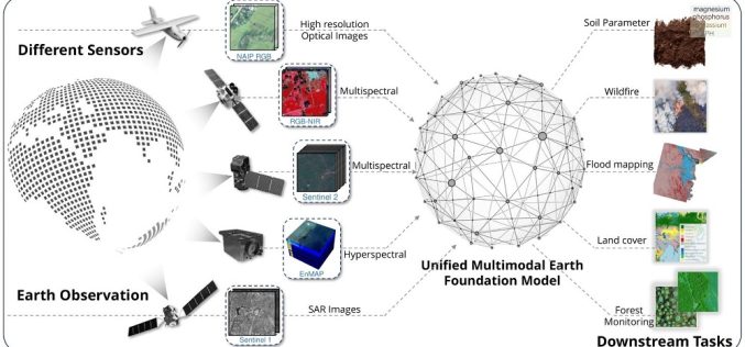
TorchGeo 0.6.0: Advancing Geospatial Machine Learning
TorchGeo 0.6 marks a significant step forward in geospatial machine learning by offering new datasets, data modules, and pre-trained models for satellite image analysis. Over 11 months, 23 contributors worked

Call for Proposals for Geospatial Technology and Solutions: Impact and Importance for India’s Future
The National Geospatial Programme (NGP) division, formerly NRDMS, calls for proposals in Geospatial Technology and Solutions that have the potential to impact various sectors in India significantly. The National Geospatial
Machine Learning to Discover Shell Rings Using Remote Sensing Data
Deep in the dense coastal forests and marshes of the American Southeast lie shell rings and shell mounds left by Indigenous people 3,000 to 5,000 years ago. Now an international
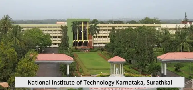
NIT Karnataka is Offering Free Course on Machine and Deep Learning for Remote Sensing Applications
NIT Karnataka is Offering is offering two weeks online summer school on Machine and Deep Learning for Remote Sensing Applications.

How MIT using LiDAR and ML for More Efficient Self-driving Car?
A LiDAR (Light Detection and Ranging) system beams light out and then precisely monitors the timing of reflections to map and track objects within its detection range. A LiDAR instrument principally

UP42 Webinar on Fusion of Satellite Imagery, AIS Data, Machine Learning for Maritime Surveillance
UP42, creator of the leading developer platform for Earth observation data and analytics, will host a free webinar on maritime monitoring and surveillance on Dec. 9, 2020. Presentations will discuss
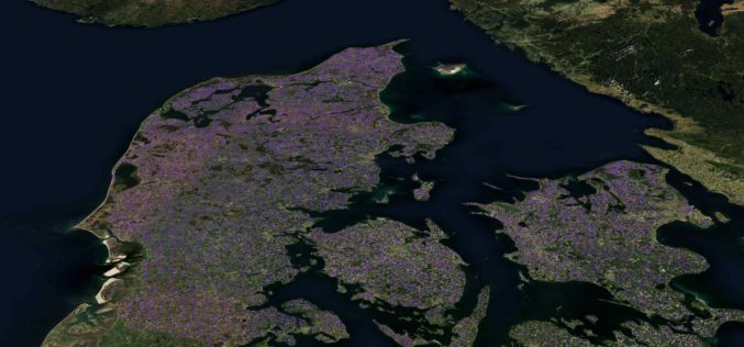
Machine Learning Helps SEGES to Detect 26K Slurry Tanks over Denmark to Assess Ammonia Emission
The article talks about How SEGES detected 26000 slurry tanks over Denmark in a few hours using Picterra to assess ammonia emission.
Join MAXAR to Learn How Satellite Data is used by Organizations in Responding to Business Disruption and Emerging from Lockdown
Join MAXAR to Learn How Satellite Data is used by Organizations in Responding to Business Disruption and Emerging from Lockdown
