Credit: Azernews
In recent news by Azernews, Iran has successfully launched its indigenously build Fajr, the fourth satellite into orbit by Safir-e-Fajr launch vehicle.
The satellite is different than the previous Iranian-made Omid, Rasad, and Navid satellites and uses micro-motors that provide it orbit-changing capability. Equipped with GPS navigation system. The satellite is different than the previous Iranian-made Omid, Rasad, and Navid satellites and uses micro-motors that provide it orbit-changing capability.
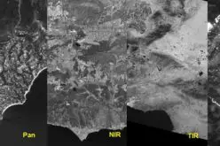
Taking photos for mapping and meteorological purposes as well as carrying tests for improving Iran’s space technology are among the Fajr’s missions.
The satellite was designed and built by Iran’s defense ministry.
Sorena Sattari, Vice-President for Science and Technology said Iran plans to put into orbit a new home-made satellite.
“We will launch a satellite this week,” Sattari said in Tehran on February 1 without revealing any further detail or the exact launch date.


