
Tag "3D mapping"
ISRO to Map and Create 3D Modelling of National Heritage Sites
Ministry of Culture, Government of India and Indian Space Research Organisation (ISRO) has collaborated to start a national project for inventory and monitoring of archaeological sites of the country. The

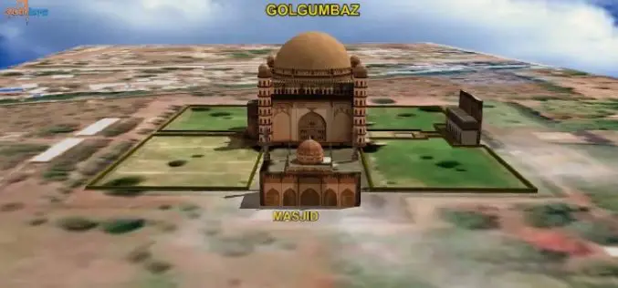
3D Mapping of Heritage Monuments for Tourism Promotion
According to recent news from ToI, the tourism department of Telangana state is going for 3D mapping of heritage monuments and buildings of city. Hyderabad city has many heritage monuments

Leica Introduce Leica Pegasus: Backpack Industry First Wearable Reality Capture
Leica Geosystems announced the commercial availability of Leica Pegasus: Backpack this week at HxGN LIVE. Leica Pegasus: Backpack is first of its kind in geospatial industry. It comes with a

NIDM Emphasizes On the Need of Digital Mapping
In recent news by ToI, ahead to the planning of Kumbh Mela in Nashik, the National Institute of Disaster Management (NIDM) has suggested digitised mapping of Nashik to create a

New Delhi to Go 3D Mapping for Smart City
According to recent news, New Delhi Municipal Council will soon start 3D mapping of city as a part of smart city project.Smart city optimally utilize information technology to habilitate the
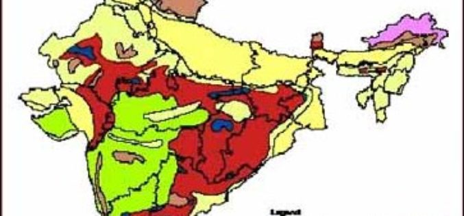
3D Mapping of Groundwater Resources of India
In recent news by Deccan Chronicle, National Geophysical Research Institute (NGRI) is planning to take up a massive a groundwater mapping programme across the entire landmass of India using advanced

Geospatial Innovation in Spotlight at Esri Conference in DC
NGA Director Robert Cardillo and Former Maryland Governor Martin O’Malley to Keynote Redlands, California—Technology and government leaders will gather for the Esri Federal GIS Conference in Washington, DC, February 9–10,

3D Mapping of Coastal Areas as a part of Tsunami Warning System
India is taking up 3D mapping of coastal areas as part of its efforts to further improve the tsunami early warning system. On the 10th anniversary of the

Webinar: Unmanned Aerial Systems for Mapping
Webinar: Unmanned Aerial Systems for Mapping January 15, 2015: 10:00 am to 11:00 am Unmanned Aerial Systems (UAS) or drones have garnered a lot of headlines recently. The term “drone”

Why the Urban Redevelopment Authority of Singapore Using 3D Mapping
According to recent news by www.futuregov.asia, The Urban Redevelopment Authority is now using 3D mapping to get a more realistic view of the city and simulate future scenarios, so agencies can
