
Tag "Airborne LiDAR"

Northeast Frontier Railway (NFR) to Conduct Airborne LiDAR Survey
The Indian Railway’s Northeast Frontier Railway (NFR) zone is set to conduct an Airborne LiDAR Survey on the Lumding to Badarpur hill section. This advanced survey will take place during
Airborne LiDAR Production Now Fully Integrated With Leica HxMap Workflow
Leica Geosystems, industry leader for reality capture and measurement technology, announced today the release of LiDAR data processing capability in the Leica RealCity solution package. Leica Geosystems partnered with international asset
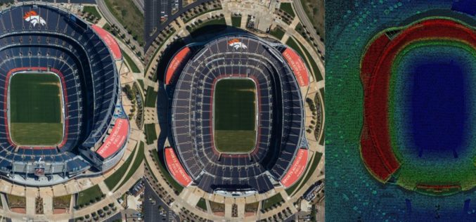
New Leica SPL100 Brings up to 10x More Efficiency to Airborne LiDAR
Latest Single Photon LiDAR technology collects 6 million points per second (Heerbrugg, Switzerland, 13 February 2017) – Leica Geosystems, industry leader of reality capture and measurement technology, announced today the

Airborne LiDAR to Throw Light on Rajgir Hill’s History
Kolkata,Nov 7, 2016- IANS – Indian archaeologists plan to deploy high-end scanning lasers on airborne platforms to survey the archaeological evidence, flora and fauna in the ancient Rajgir hills in
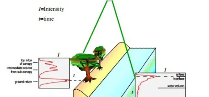
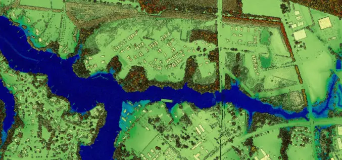
Algorithms used in the Airborne Lidar Processing System (ALPS)
The Airborne Lidar Processing System (ALPS) analyzes Experimental Advanced Airborne Research Lidar (EAARL) data—digitized laser-return waveforms, position, and attitude data—to drive point clouds of target surfaces. A full-waveform airborne lidar
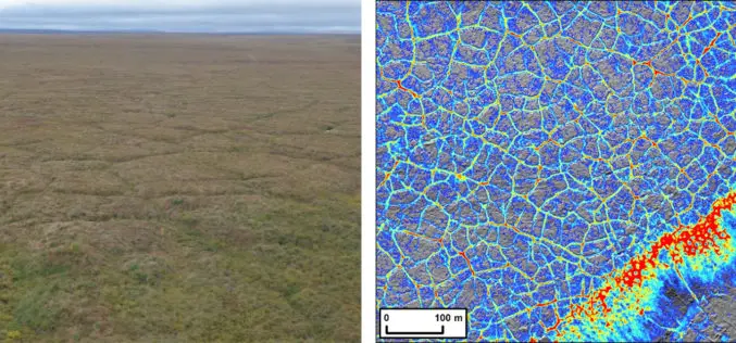
Arctic Tundra Fire Causes Widespread Permafrost Landscape Changes
ANCHORAGE, Alaska – Large and severe tundra fires cause top down permafrost thaw, playing a major role in altering Arctic landscapes according to a new study led by the U.S.
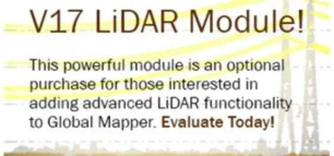
Updated Global Mapper LiDAR Module with Power Line Classification and Extraction
Blue Marble Geographics is pleased to announce the release of Global Mapper LiDAR module version 17.0. Released in conjunction with Version 17.0 of Global Mapper, the latest edition of the module includes
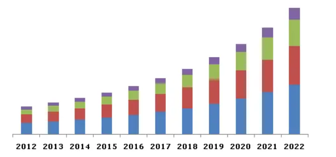
Global LiDAR Market By Product, By Application, By Component Expected To Reach USD 944.3 Million By 2022
The global LiDAR market is expected to reach USD 944.3 million by 2022, according to a new study by Grand View Research, Inc. Escalating demand for 3D imagery in line
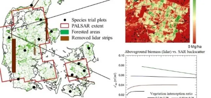
L-Band SAR Backscatter Related to Forest Cover, Height and Aboveground Biomass at Multiple Spatial Scales across Denmark
L-Band SAR Backscatter Related to Forest Cover, Height and Aboveground Biomass at Multiple Spatial Scales across Denmark – Neha P. Joshi, Edward T. A. Mitchard, Johannes Schumacher, Vivian K. Johannsen, Sassan Saatchi and
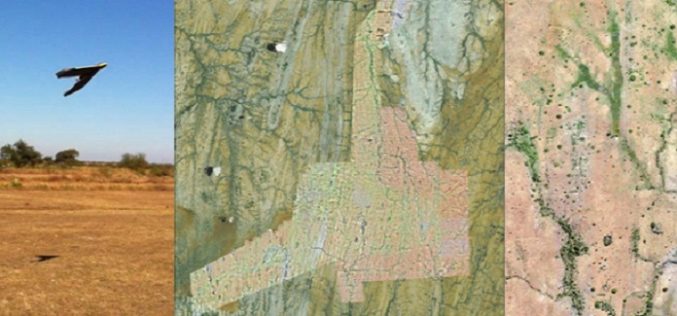
A Case Study: Using Drones in Place of LiDAR
Energizer Resources Inc., has started a major flagship project, a large graphite mining project at coast of East Africa, in Madagascar. it is named the Molo Graphite Project, or simply
