
Tag "SAR"
Webinar Series: DEM Extraction from SAR Imagery
Get More From Imagery Webinar Series: DEM Extraction from SAR Imagery Nov. 19, 2015 at 4am EDT (9am GMT) | Nov. 19, 2015 at 2pm EDT (7pm GMT) PCI Geomatics is the
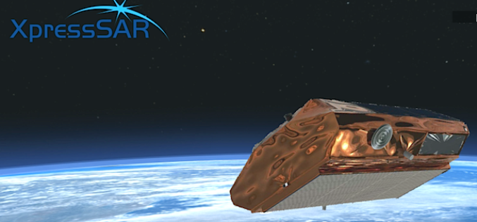
XpressSAR: High Revisit, High Resolution, All Weather SAR Satellite Constellation
XpressSAR Inc. is an American owned and operated company. XpressSAR will be a constellation of four small Synthetic Aperture Radar (SAR satellites with an average revisit rate of less than 4
Digital Mapping of Alaska Completed Halfway
As reported in Alaska Dispatch News, Alaska is one-fifth the size of the U.S. and covered with treacherous terrain, because of which creating map of such areas is quite difficult in
SAR Processing in Geomatica – Online Training
SAR processing in Geomatica is an advanced course that explores data preparation, processing and analysis techniques for working with Synthetic Aperture Radar (SAR) data. In this 3-day course, participants will

Talk: From SAR to spatial data infrastructures – Applied remote sensing at the Chair of Remote Sensing at the Friedrich-Schiller-University Jena
From SAR to spatial data infrastructures – Applied remote sensing at the Chair of Remote Sensing at the Friedrich-Schiller-University Jena, Germany by Carsten Pathe, Jonas Eberle The talk will give
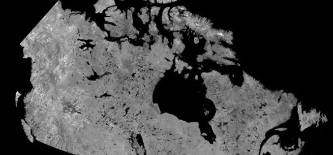
Download Free RADARSAT Data of Canada
Canada’s RADARSAT-1 is a radar satellite and was launched in November 1995. It carries a Synthetic Aperture Radar (SAR), it acquired images of the Earth day or night, in all

2 PhD Positions in SAR Remote Sensing at the University of Zurich
The University of Zurich is one of the leading research universities in Europe and offers the widest range of study courses in Switzerland. The University of Zurich and Eawag provide generous research support,

PCI Geomatics Guest Lecturing at Canadian University on Synthetic Aperture Radar (SAR)
MARKHAM, Ontario, Canada—March 10, 2015: PCI Geomatics, a world leading developer of remote sensing and photogrammetric software and systems, announced today that Gabriel Gosselin, PhD., Radar Remote Sensing Scientist for
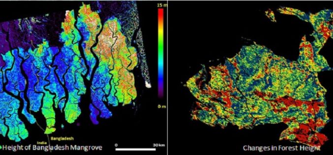
Mapping Forest Structure From Space
Over the last 10 years a new method using satellite radar data has been maturing to provide 3D views of Earth’s natural resources and urban environments. Scientists from around the
PCI Geomatics announces strategic partnership with MDA for Accessing RADARSAT-2 Imagery
PCI Geomatics, a world leading developer of remote sensing and photogrammetric software and systems, announced today a strategic partnership with McDonald, Dettwiler and Associated Ltd. (MDA). The partnership introduces a solution that
