
Tag "SAR"

From Desert to Orbit: UAE Unveils First SAR Satellite
The UAE successfully launched its first Synthetic Aperture Radar (SAR) satellite on August 16, 2024, as part of its Earth Observation Space Program. This satellite, developed through a collaboration between

Call for Proposals for Geospatial Technology and Solutions: Impact and Importance for India’s Future
The National Geospatial Programme (NGP) division, formerly NRDMS, calls for proposals in Geospatial Technology and Solutions that have the potential to impact various sectors in India significantly. The National Geospatial
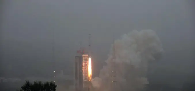
China Launches Two Microwave Satellite System – Tianhui 2
China successfully launched the Tianhui 2 microwave surveying satellite system using a Long March-4B carrier rocket that blasts off from the Taiyuan Satellite Launch Center in north China’s Shanxi Province,

ISRO Launches EOS-01 and Nine Other Satellites
EOS-01 is an earth observation satellite intended for applications in agriculture, forestry and disaster management support.
HARRIS Geospatial Solutions Webinar: The Applications and Benefits of Synthetic Aperture Radar (SAR)
Synthetic Aperture Radar (SAR) is rapidly becoming a key dataset in geospatial investigation. Unlike many other observational methods, SAR is not limited by illumination or cloud cover. In recent years,
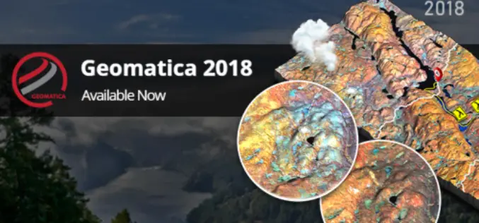
PCI Geomatics Releases Geomatica and GXL 2018
MARKHAM, Ontario, Canada, October 1, 2018 — PCI Geomatics announced today the release of Geomatica 2018, the company’s flagship software for complete and integrated desktop and enterprise geoimage processing. Geomatica
MDA to Provide RADARSAT-2 Information to Meet Critical and Complex Challenges for Land and Maritime Monitoring
March 26, 2018 – Richmond, BC – MDA, a Maxar Technologies company (formerly MacDonald, Dettwiler and Associates Ltd.), (NYSE: MAXR; TSX: MAXR), announced today it has recently signed multiple geospatial-related
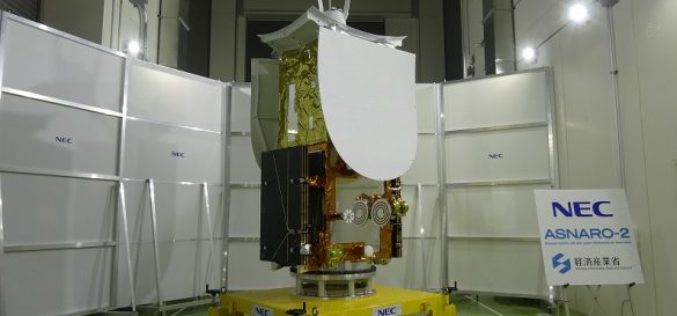
Japan Successfully Launches Small Radar Imaging Satellite “ASNARO-2”
January 18, 2017, JAXA – JAXA successfully launched Epsilon-3, the third Epsilon launch vehicle which encapsulates NEC Small radar satellite “ASNARO-2”, from the JAXA Uchinoura Space Center. The launch occurred on
Learn SNAP Using EU Flagship Copernicus Satellite Program
Geo University has come up with a video course that provides a detailed walkthrough guide of the European Space Agency (ESA) Sentinels Application Platform (SNAP) software. A common architecture for all Sentinel Toolboxes is

UrtheCast and e-GEOS Collaborate to Offer Unique Optical and SAR Products
Madrid, October 20, 2017 – UrtheCast Corp., its subsidiary Deimos Imaging and e-GEOS (a company owned by Telespazio and the Italian Space Agency)today announced a strategic partnership to offer a
