
Tag "ISRO"

Opportunity for Utilizing Chandrayaan-1 Data from Terrain Mapping Camera and Hyperspectral Imager
Space Applications Centre (SAC), Indian Space Research Organisation (ISRO), Department of Space (DOS), Government of India, declares an “Announcement of Opportunity (AO)” to carry out scientific research by utilisation of
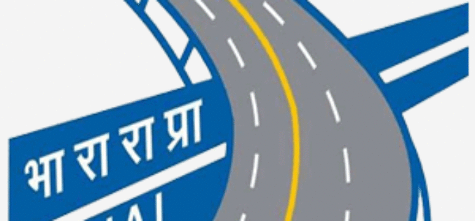
Satellite Mapping of National Highways
In recent news by Business Standard, the National Highways Authority of India (NHAI) is planning to sign a memorandum of understanding (MoU) with the Indian Space Research Organisation (ISRO) to adopt
Indian Railways to Tie Up With ISRO for Enhanced Safety Using GPS Aided System (GAGAN)
Indian Railways will join hands with ISRO to get online satellite images for improving safety and enhancing efficiency. “We will undertake a massive exercise of GIS mapping of the entire

ISRO Teams Up With Urban Development Ministry, To Map 4,041 Towns
The Indian Space Research Organisation (ISRO) has tied up with the Union Urban Development Ministry for mapping over 500 towns and cities, to make a base plan for better planning

ISRO to Map and Create 3D Modelling of National Heritage Sites
Ministry of Culture, Government of India and Indian Space Research Organisation (ISRO) has collaborated to start a national project for inventory and monitoring of archaeological sites of the country. The

ISRO Stresses on Research on Geospatial Technology
According to recent news by ToI, Indian Space Research Organization (ISRO) chairman A S Kiran Kumar stressed on the importance of cultivating a large student workforce for academic research especially
NRSC Announces Course on Hyperspectral Remote Sensing
National Remote Sensing Agency (NRSA) was established as a registered society on 2nd September 1974 by Department of Science & Technology, based on a Union Cabinet approval dated December 13,
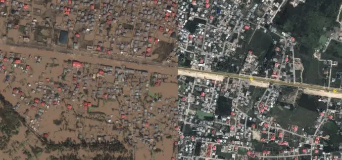
Kashmir Floods Monitored By Latest Satellite Technology
Union Minister Jitendra Singh said that Kashmir floods are being constantly monitored by latest satellite technology at the National Remote Sensing Centre. “Kashmir floods are being constantly monitored by latest

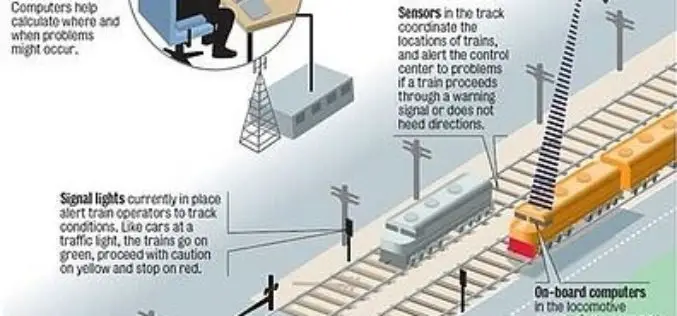
GAGAN to Save Lives at Unmanned Railway Crossings
The Indian Railways is in talks with the Indian space agency on the possibility of using GPS-aided geo-augmented navigation (GAGAN) for safety at unmanned railway crossings, said a top ISRO official. The
27 Indian Satellites Currently Operational: Govt
25 Feb. 2015 – As many as 27 satellites, including 11 which facilitate the communication network in the country, are currently operational and one more is to be launched next
